Dover Hill, Indiana
| Dover Hill | |
|---|---|
| census-designated place | |
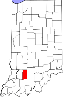 Martin County's location in Indiana | |
 Dover Hill Location in Martin County | |
| Coordinates: 38°43′30″N 86°48′10″W / 38.72500°N 86.80278°WCoordinates: 38°43′30″N 86°48′10″W / 38.72500°N 86.80278°W | |
| Country | United States |
| State | Indiana |
| County | Martin |
| Township | Center |
| Elevation | 663 ft (202 m) |
| ZIP code | 47553 |
| FIPS code | 18-18550[1] |
| GNIS feature ID | 450862[2] |
Dover Hill is an unincorporated census-designated place in Center Township, Martin County, Indiana. Indiana Hwy 450 runs through the town.
History
Dover Hill contained a post office from 1846 until 1906.[3] The community was likely named after Dover, in England.[4]
References
- ↑ "American FactFinder". United States Census Bureau. Retrieved 2008-01-31.
- ↑ "Dover Hill, Indiana". Geographic Names Information System. United States Geological Survey. Retrieved 2009-10-10.
- ↑ "Martin County". Jim Forte Postal History. Retrieved 2 February 2015.
- ↑ Baker, Ronald L. (October 1995). From Needmore to Prosperity: Hoosier Place Names in Folklore and History. Indiana University Press. p. 116. ISBN 978-0-253-32866-3.
...reminded English settlers of the cliffs of Dover, England.
Municipalities and communities of Martin County, Indiana, United States | ||
|---|---|---|
| City | ||
| Towns | ||
| Townships | ||
| CDPs | ||
| Other unincorporated communities | ||
This article is issued from Wikipedia - version of the 10/24/2016. The text is available under the Creative Commons Attribution/Share Alike but additional terms may apply for the media files.