Dixon, New Orleans
| Dixon | |
| New Orleans Neighborhood | |
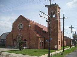 St. Theresa Little Flower Church | |
| Country | United States |
|---|---|
| State | Louisiana |
| City | New Orleans |
| Planning District | District 3, Uptown/Carrollton |
| Elevation | 0 ft (0.0 m) |
| Coordinates | 29°58′16″N 90°06′49″W / 29.97111°N 90.11361°WCoordinates: 29°58′16″N 90°06′49″W / 29.97111°N 90.11361°W |
| Area | 0.24 sq mi (0.6 km2) |
| - land | 0.24 sq mi (1 km2) |
| - water | 0.00 sq mi (0 km2), 0% |
| Population | 565 (2010) |
| Density | 2,354/sq mi (909/km2) |
| Timezone | CST (UTC-6) |
| - summer (DST) | CDT (UTC-5) |
| Area code | 504 |
Dixon is a neighborhood of the city of New Orleans. A subdistrict of the Uptown/Carrollton Area, its boundaries as defined by the City Planning Commission are: Interstate 10 to the northeast, South Carrollton Avenue to the southeast, Palmetto Street to the southwest and Cherry, Dixon, Mistletoe, Peach, Hamilton, Quince and Last Streets to the northwest.
Geography
Dixon is located at 29°58′16″N 90°06′49″W / 29.97111°N 90.11361°W [1] and has an elevation of 0 feet (0.0 m).[2] According to the United States Census Bureau, the district has a total area of 0.24 square miles (0.6 km2). 0.24 square miles (0.6 km2) of which is land and 0.00 square miles (0.0 km2) (0.0%) of which is water.
Adjacent Neighborhoods
- Lakewood (north)
- Mid-City (northeast)
- Gert Town (south)
- Hollygrove (southwest)
Boundaries
The City Planning Commission defines the boundaries of Dixon as these streets: Interstate 10, South Carrollton Avenue, Palmetto Street, Cherry Street, Dixon Street, Mistletoe Street, Peach Street, Hamilton Street, Quince Street and Last Street.[3]
Demographics
As of the census of 2000, there were 1,772 people, 668 households, and 445 families residing in the neighborhood. The population density was 7,383 /mi² (2,953 /km²). The racial makeup of the neighborhood was 94.9% African American, 3.2% White, 0.1% Asian, and 0.3% from two or more races. Hispanic or Latino of any race were 1.5% of the population.[4]
As of the census of 2010, there were 1,270 people, 520 households, and 319 families residing in the neighborhood. The racial makeup of the neighborhood was 90.3% African American, 6.0% White, 0.1% Asian, 0.2% American Indian, and 0.6% from two or more races. Hispanic or Latino of any race were 2.8% of the population.[4]
See also
| Wikimedia Commons has media related to Dixon, New Orleans. |
References
- ↑ "US Gazetteer files: 2010, 2000, and 1990". United States Census Bureau. 2011-02-12. Retrieved 2011-04-23.
- ↑ "US Board on Geographic Names". United States Geological Survey. 2007-10-25. Retrieved 2008-01-31.
- ↑ Greater New Orleans Community Data Center. "Dixon Neighborhood". Retrieved 2008-06-21.
- 1 2 "Dixon Neighborhood". Greater New Orleans Community Data Center. Retrieved 5 January 2012.
 |
Lakewood | | ||
| Hollygrove | |
Mid-City | ||
| ||||
| | ||||
| Gert Town |