Delana Township, Humboldt County, Iowa
| Delana Township | |
|---|---|
| Township | |
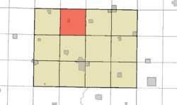 Location in Humboldt County | |
| Coordinates: 42°51′50″N 94°16′17″W / 42.86389°N 94.27139°WCoordinates: 42°51′50″N 94°16′17″W / 42.86389°N 94.27139°W | |
| Country |
|
| State |
|
| County | Humboldt |
| Established | 1870 |
| Area | |
| • Total | 36.3 sq mi (94 km2) |
| • Land | 36.3 sq mi (94 km2) |
| • Water | 0.0 sq mi (0 km2) |
| Elevation | 1,135 ft (346 m) |
| Population (2000) | |
| • Total | 532 |
| • Density | 15/sq mi (5.8/km2) |
| Time zone | CST (UTC-6) |
| • Summer (DST) | CDT (UTC-5) |
| ZIP codes | 50519 (Bode) |
| GNIS feature ID | 0467697 |
Delana Township is one of twelve townships in Humboldt County, Iowa, USA.[1] As of the 2000 census, its population was 532.
History
Delana Township was organized in 1871.[2]
Geography
According to the United States Census Bureau, Delana Township covers an area of 36.3 square miles (94 km2), all of this is land.
Cities, towns, villages
Adjacent townships
- Riverdale Township, Kossuth County (north)
- Sherman Township, Kossuth County (northeast)
- Humboldt Township (east)
- Grove Township (southeast)
- Rutland Township (south)
- Avery Township (southwest)
- Wacousta Township (west)
- Garfield Township, Kossuth County (northwest)
Cemeteries
The township contains St. Olaf Cemetery, and Union Cemetery, also Bode Memorial Park.[1]
Political districts
- Iowa's 4th congressional district
- State House District 4
References
- United States Census Bureau 2008 TIGER/Line Shapefiles
- United States Board on Geographic Names (GNIS)
- United States National Atlas
- 1 2 3 "Delana township, Humboldt County, Iowa (IA)." U.S. Census Bureau. Breakdown. Retrieved January 17, 2010.
- ↑ History of Kossuth and Humboldt Counties, Iowa. Union Publishing Company. 1884. p. 755. Note that Google Books misspells "Humboldt".
External links

Municipalities and communities of Humboldt County, Iowa, United States | ||
|---|---|---|
| Cities | ||
| Townships | ||
| Ghost town |
| |
| Footnotes | ‡This populated place also has portions in an adjacent county or counties | |
This article is issued from Wikipedia - version of the 9/27/2016. The text is available under the Creative Commons Attribution/Share Alike but additional terms may apply for the media files.