Deary, Idaho
| Deary, Idaho | |
|---|---|
| City | |
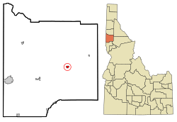 Location in Latah County and the state of Idaho | |
| Coordinates: 46°48′0″N 116°33′31″W / 46.80000°N 116.55861°WCoordinates: 46°48′0″N 116°33′31″W / 46.80000°N 116.55861°W | |
| Country | United States |
| State | Idaho |
| County | Latah |
| Area[1] | |
| • Total | 0.65 sq mi (1.68 km2) |
| • Land | 0.65 sq mi (1.68 km2) |
| • Water | 0 sq mi (0 km2) |
| Elevation | 2,874 ft (876 m) |
| Population (2010)[2] | |
| • Total | 506 |
| • Estimate (2012[3]) | 512 |
| • Density | 778.5/sq mi (300.6/km2) |
| Time zone | Pacific (PST) (UTC-8) |
| • Summer (DST) | PDT (UTC-7) |
| ZIP code | 83823 |
| Area code(s) | 208 |
| FIPS code | 16-20890 |
| GNIS feature ID | 0399848 |
| Website | www.dearyidaho.com |
Deary is a city in Latah County, Idaho, United States. The population was 506 at the 2010 census, down from 552 in 2000.[4] It is located 24 miles (39 km) east of Moscow and 43 miles (69 km) northeast of Lewiston.
History
Deary had its start when the railroad was extended to that point.[5] The town was founded in 1907, and named for William Deary, a businessperson in the lumber industry.[6] A post office has been in operation at Deary since 1907.[7]
Geography
Deary lies at an elevation of 2,874 feet (876 m) above sea level. Deary is located at the base of Potato Hill,[8] or as the locals call it, "Spud Hill" and close to outdoor recreation, including camping and fishing: between Spring Valley Reservoir and Moose Creek.
According to the United States Census Bureau, the city has a total area of 0.65 square miles (1.68 km2), all of it land.[1]
Demographics
| Historical population | |||
|---|---|---|---|
| Census | Pop. | %± | |
| 1920 | 316 | — | |
| 1930 | 295 | −6.6% | |
| 1940 | 320 | 8.5% | |
| 1950 | 320 | 0.0% | |
| 1960 | 349 | 9.1% | |
| 1970 | 411 | 17.8% | |
| 1980 | 539 | 31.1% | |
| 1990 | 529 | −1.9% | |
| 2000 | 552 | 4.3% | |
| 2010 | 506 | −8.3% | |
| Est. 2015 | 508 | [9] | 0.4% |
2010 census
As of the census[2] of 2010, there were 506 people, 204 households, and 143 families residing in the city. The population density was 778.5 inhabitants per square mile (300.6/km2). There were 221 housing units at an average density of 340.0 per square mile (131.3/km2). The racial makeup of the city was 93.5% White, 0.2% African American, 1.0% Native American, 0.8% Asian, 0.8% from other races, and 3.8% from two or more races. Hispanic or Latino of any race were 2.2% of the population.
There were 204 households of which 33.3% had children under the age of 18 living with them, 57.8% were married couples living together, 7.4% had a female householder with no husband present, 4.9% had a male householder with no wife present, and 29.9% were non-families. 21.6% of all households were made up of individuals and 9.3% had someone living alone who was 65 years of age or older. The average household size was 2.48 and the average family size was 2.94.
The median age in the city was 39.3 years. 24.5% of residents were under the age of 18; 5.7% were between the ages of 18 and 24; 26% were from 25 to 44; 30% were from 45 to 64; and 13.6% were 65 years of age or older. The gender makeup of the city was 52.4% male and 47.6% female.
2000 census
As of the census[11] of 2000, there were 552 people, 214 households, and 156 families residing in the city. The population density was 921.6 people per square mile (355.2/km²). There were 235 housing units at an average density of 392.4 per square mile (151.2/km²). The racial makeup of the city was 96.20% White, 0.18% Native American, 0.54% Asian, 0.72% from other races, and 2.36% from two or more races. Hispanic or Latino of any race were 3.44% of the population.
There were 214 households out of which 33.2% had children under the age of 18 living with them, 62.1% were married couples living together, 5.1% had a female householder with no husband present, and 27.1% were non-families. 21.0% of all households were made up of individuals and 5.6% had someone living alone who was 65 years of age or older. The average household size was 2.58 and the average family size was 2.97.
In the city the population was spread out with 26.4% under the age of 18, 10.1% from 18 to 24, 27.2% from 25 to 44, 23.0% from 45 to 64, and 13.2% who were 65 years of age or older. The median age was 36 years. For every 100 females there were 97.1 males. For every 100 females age 18 and over, there were 102.0 males.
The median income for a household in the city was $36,167, and the median income for a family was $40,750. Males had a median income of $31,875 versus $19,688 for females. The per capita income for the city was $16,244. About 7.3% of families and 8.7% of the population were below the poverty line, including 15.6% of those under age 18 and 5.6% of those age 65 or over.
Education
Deary has 2 schools, Bovill Elementary and Deary Jr-Sr High.
References
- 1 2 "US Gazetteer files 2010". United States Census Bureau. Retrieved 2012-12-18.
- 1 2 "American FactFinder". United States Census Bureau. Retrieved 2012-12-18.
- ↑ "Population Estimates". United States Census Bureau. Retrieved 2013-06-03.
- ↑ Spokesman-Review - 2010 census - Deary, Idaho - accessed 2011-12-26
- ↑ Cross, Helen (Mar 9, 1978). "Interest in towns revitalized". Spokane Daily Chronicle. p. 3. Retrieved 31 October 2015.
- ↑ Lewis, Marilyn (May 13, 1988). "Deary named for lumberman". Moscow-Pullman Daily News. p. 26. Retrieved 18 October 2015.
- ↑ "Latah County". Jim Forte Postal History. Retrieved 14 April 2015.
- ↑ Cross, Helen (Mar 9, 1978). "Interest in towns revitalized". Spokane Daily Chronicle. p. 3. Retrieved 31 October 2015.
- ↑ "Annual Estimates of the Resident Population for Incorporated Places: April 1, 2010 to July 1, 2015". Retrieved July 2, 2016.
- ↑ "Census of Population and Housing". Census.gov. Retrieved June 4, 2015.
- ↑ "American FactFinder". United States Census Bureau. Retrieved 2008-01-31.
External links
- deary-id.com - community site
- - community site, local business listings
- Latah County Historical Society
Municipalities and communities of Latah County, Idaho, United States | ||
|---|---|---|
| Cities | ||
| CDP | ||
| Unincorporated communities | ||