DeCordova, Texas
| DeCordova, Texas | |
|---|---|
| City | |
| Nickname(s): Millennium City | |
 Location of DeCordova, Texas | |
| Country | United States |
| State | Texas |
| County | Hood |
| Elevation | 725 ft (221 m) |
| • Density | 1/sq mi (0.4/km2) |
| Time zone | Central (CST) (UTC-6) |
| • Summer (DST) | CDT (UTC-5) |
| Area code(s) | 817 |
| Website | www.dcbeweb.com |
DeCordova is a city in Hood County, Texas, United States. According to a 2009 U.S. census estimate, its population is 3,365.[1]
It is a gated residential community located on Lake Granbury, six miles east-southeast of Granbury and is part of the Granbury, Texas Micropolitan Statistical Area.
History
DeCordova Bend Estates started being developed at the same time as the DeCordova Dam in the late 1960s. The dam, built on the Brazos River to control the flow downstream, formed Lake Granbury. The new community was intended to serve as a weekend recreational getaway for residents of the Dallas/Fort Worth Metroplex. The gated community has become a sanctuary for notable individuals. It is an all age residential community, 32 miles southwest of Fort Worth, Texas. It has a recently renovated clubhouse, 27 holes of golf, marina, swimming pool, tennis, fitness center and other amenities. DeCordova was named after Jacob Raphael De Cordova, the land agent and colonizer. He was born in Spanish Town (near Kingston), Jamaica. De Cordova and Robert Creuzbaurqv compiled the Map of the State of Texas, first published in 1849.
The city of DeCordova incorporated on January 15, 2000,[2] DeCordova was the first city in Texas to be incorporated after the turn of the century and claims the title of Texas' "Millennium City".
Demographics
| Historical population | |||
|---|---|---|---|
| Census | Pop. | %± | |
| 2010 | 2,683 | — | |
| Est. 2015 | 2,855 | [3] | 6.4% |
City government
The city has a mayor-council form of government and all city residents are members of the DeCordova Bend Estates Owners Association and the DeCordova Bend Estates Country Club. The Granbury Independent School District serves area students. Students attend Acton Elementary, Acton Middle, Crossland 9th Grade Center and the three year Granbury High school, all outside the city limits.
References
- ↑ "Table 4: Annual Estimates of the Resident Population for Incorporated Places in Texas, Listed Alphabetically: April 1, 2000 to July 1, 2009" (CSV). United States Census Bureau, Population Division. 2010-06-22. Retrieved 2010-06-24.
- ↑ "Boundary Changes". Geographic Change Notes: Texas. Population Division, United States Census Bureau. 2006-05-19. Retrieved 2008-05-27.
- ↑ "Annual Estimates of the Resident Population for Incorporated Places: April 1, 2010 to July 1, 2015". Retrieved July 2, 2016.
- ↑ "Census of Population and Housing". Census.gov. Retrieved June 4, 2015.
External links
- DeCordova, Texas from the Handbook of Texas Online
Municipalities and communities of Hood County, Texas, United States | ||
|---|---|---|
| Cities | 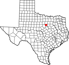 | |
| CDPs |
| |
| Unincorporated communities | ||
| Footnotes | ‡This populated place also has portions in an adjacent county or counties | |
Coordinates: 32°25′48″N 97°41′42″W / 32.43000°N 97.69500°W