Danglas, Abra
| Danglas | ||
|---|---|---|
| Municipality | ||
| ||
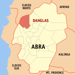 Location within Abra province | ||
.svg.png) Danglas Location within the Philippines | ||
| Coordinates: 17°41′N 120°40′E / 17.68°N 120.66°ECoordinates: 17°41′N 120°40′E / 17.68°N 120.66°E | ||
| Country | Philippines | |
| Region | Cordillera Administrative Region (CAR) | |
| Province | Abra | |
| District | Lone District of Abra | |
| Barangays | 7 (see Barangays) | |
| Government [1] | ||
| • Type | Sangguniang Bayan | |
| • Mayor | Esther B. Bernos | |
| Area[2] | ||
| • Total | 156.02 km2 (60.24 sq mi) | |
| Population (2015 census)[3] | ||
| • Total | 4,192 | |
| • Density | 27/km2 (70/sq mi) | |
| • Voter (2016)[4] | 2,888 | |
| Time zone | PST (UTC+8) | |
| ZIP code | 2825 | |
| IDD : area code | +63 (0)74 | |
| Income class | 5th class | |
| PSGC | 140106000 | |

Danglas, officially the Municipality of Danglas (Ilocano: Ili ti Danglas, Filipino: Bayan ng Danglas), is a municipality in the province of Abra in the Cordillera Administrative Region (CAR) of the Philippines. The population was 4,192 at the 2015 census.[3] In the 2016 election, it had 2,888 registered voters.[4]
Geography
Danglas is located at 17°41′N 120°40′E / 17.68°N 120.66°E.
According to the Philippine Statistics Authority, the municipality has a land area of 156.02 square kilometres (60.24 sq mi)[2] constituting 3.75% of the 4,165.25-square-kilometre- (1,608.21 sq mi) total area of Abra.
Barangays
Danglas is politically subdivided into 7 barangays.[5]
| PSGC | Barangay | Population | ±% p.a. | ||
|---|---|---|---|---|---|
| 2015[3] | 2010[6] | ||||
| 140106001 | Abaquid | 6.6% | 275 | 423 | −7.87% |
| 140106003 | Cabaruan | 16.1% | 673 | 650 | +0.66% |
| 140106004 | Caupasan (Poblacion) | 32.4% | 1,359 | 1,398 | −0.54% |
| 140106005 | Danglas | 8.5% | 357 | 479 | −5.44% |
| 140106006 | Nagaparan | 19.2% | 803 | 819 | −0.37% |
| 140106007 | Padangitan | 9.9% | 417 | 502 | −3.47% |
| 140106008 | Pangal | 7.3% | 308 | 463 | −7.47% |
| Total | 4,192 | 4,734 | −2.29% | ||
Demographics
| Population census of Danglas | |||||||||||||||||||||||||
|---|---|---|---|---|---|---|---|---|---|---|---|---|---|---|---|---|---|---|---|---|---|---|---|---|---|
|
| ||||||||||||||||||||||||
| Source: PSA[3][6][7] | |||||||||||||||||||||||||
In the 2015 census, Danglas had a population of 4,192.[3] The population density was 27 inhabitants per square kilometre (70/sq mi).
In the 2016 election, it had 2,888 registered voters.[4]
Economy
The economy of the municipality is heavily dependent on agriculture particularly palay, corn, vegetables and fruits. Other raw materials include rattan and bamboos.
References
- ↑ "Municipality". Quezon City, Philippines: Department of the Interior and Local Government. Retrieved 31 May 2013.
- 1 2 "Province: Abra". PSGC Interactive. Makati City, Philippines: Philippine Statistics Authority. Retrieved 28 October 2016.
- 1 2 3 4 5 "CORDILLERA ADMINISTRATIVE REGION (CAR)". Census of Population (2015): Total Population by Province, City, Municipality and Barangay (Report). PSA. Retrieved 20 June 2016.
- 1 2 3 "2016 National and Local Elections Statistics". Commission on Elections. 2016.
- ↑ "Municipal: Danglas, Abra". PSGC Interactive. Quezon City, Philippines: Philippine Statistics Authority. Retrieved 8 January 2016.
- 1 2 "CORDILLERA ADMINISTRATIVE REGION (CAR)". Census of Population and Housing (2010): Total Population by Province, City, Municipality and Barangay (Report). NSO. Retrieved 29 June 2016.
- ↑ "CORDILLERA ADMINISTRATIVE REGION (CAR)". Census of Population (1995, 2000 and 2007): Total Population by Province, City and Municipality (Report). NSO. Archived from the original on 24 June 2011.
External links
| Wikimedia Commons has media related to Danglas, Abra. |
 |
Nueva Era, Ilocos Norte | | ||
| Nueva Era, Ilocos Norte | |
Lagayan | ||
| ||||
| | ||||
| Bangued | La Paz |
Bangued (capital) | |
| Municipalities | |
| Barangays | |