Cutch Agency
| Cutch Agency | |||||
| Agency of British India | |||||
| |||||
 | |||||
| History | |||||
| • | Established | 1819 | |||
| • | Formation of the Western India States Agency | 1922 | |||
| Area | |||||
| • | 1901 | 19,725 km2 (7,616 sq mi) | |||
| Population | |||||
| • | 1901 | 488,022 | |||
| Density | 24.7 /km2 (64.1 /sq mi) | ||||
| | |||||
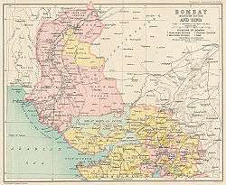
The Cutch Agency was one of the agencies of British India. The appointed Political Agent looked after only one territory, that of the princely state of Cutch, which had a surface of 19,725 km², not including the Rann of Kutch.
The agency's headquarters were at Bhuj,[1] where the Political Agent used to reside. He reported to the Political Department office at Bombay, Bombay Presidency.[2]
History
The agency was formed in 1819 when Cutch State became a British protectorate.
Captain James MacMurdo was appointed first Political Agent, as Collector and Resident of Cutch. He worked from his office at Anjar[3] while the capital of Cutch State was located away at Bhuj.
The progressive prosperity of Cutch was devastated by the famine of 1899-1900, which was felt everywhere with extreme severity; between 1891 and 1901 the population of the state of Cutch decreased from 558,415 inhabitants in 1891 to 488,022 in 1901, owing to the famine.[4]
On 10 October 1924 the Cutch Agency was abolished and merged into the Western India States Agency, which had four subdivisions.[5][1] [6]
References
- 1 2 The Indian Year Book, Volume 11 by Bennett, Coleman & Company, 1924,pp:151-152
- ↑ Sessional Papers - Volume 31, Great Britain. Parliament. House of Commons published by H.M. Stationery Office, 1900 - Page 464
- ↑ Gazetteer, Volume 5 By Bombay (India : State). 1880. p. 268. Retrieved 20 September 2014.
- ↑ The Imperial Gazetteer of India, British India Office.
- ↑ The India Office and Burma Office List by Harrison and sons, Limited, 1922- Page 393
- ↑ The Indian and Pakistan Year Book , Volume 23. 1936. p. 172.
Coordinates: 23°54′N 70°22′E / 23.900°N 70.367°E