Cuba, Alabama
| Cuba | |
|---|---|
| Town | |
|
Welcome sign to Cuba | |
 Location in Sumter County and the state of Alabama | |
| Coordinates: 32°26′1″N 88°22′18″W / 32.43361°N 88.37167°W | |
| Country | United States |
| State | Alabama |
| County | Sumter |
| Area | |
| • Total | 4.1 sq mi (10.5 km2) |
| • Land | 4.1 sq mi (10.5 km2) |
| • Water | 0 sq mi (0 km2) |
| Elevation | 223 ft (68 m) |
| Population (2010) | |
| • Total | 346 |
| • Density | 88.5/sq mi (34.6/km2) |
| Time zone | Central (CST) (UTC-6) |
| • Summer (DST) | CDT (UTC-5) |
| ZIP code | 36907 |
| Area code(s) | 205 |
| FIPS code | 01-18952 |
| GNIS feature ID | 0116945 |

Cuba is a town in Sumter County, Alabama, United States. At the 2010 census the population was 346, down from 363 in 2000.
History
The Cuba post office existed prior to 1850, with nothing in the present-day area of the town of Cuba but wilderness. The first people to live in this site were a slaveowner named Mr. R.A. Clay, who moved from Autauga County with his family and approximately 100 slaves in 1852, and purchased all the land which later made up the town of Cuba. By 1861, the town was a thriving farming industry and had a sizable truck-crop enterprise. Also during this time, the Southern Railroad was being built. Clay donated land for the railroad right-of-way, built mainly by the people he enslaved. As the town was settled, the post office became known as Cuba Station. The Town of Cuba was incorporated in 1890 with Dr. A.L. Vaughan as its first mayor.
In 1870, Mr. Clay sold to Mr. Warner Lewis half of the town and divided it into lots, with two set aside for the building of the Baptist and Methodist churches. Cuba Baptist Church was organized in 1879; the original building still stands on the spot where it was first built. The Methodist Church was organized about 1884. This church membership dissolved many years ago. The Holiness Church was organized about 1886, the Presbyterian Church about 1906, and the Independent Holiness Church about 1925.
Mrs. Curtis Vaughan was the first person to be buried in Cuba, in 1888. Mr. R.A. Clay, the morning after her death, donated the land for the Cuba Cemetery, which later became Clay Memorial Cemetery in his honor.
Geography
Cuba is located at 32°26′2″N 88°22′18″W / 32.43389°N 88.37167°W (32.433782, -88.371776).[1]
According to the U.S. Census Bureau, the town has a total area of 4.1 square miles (11 km2), of which 4.1 square miles (11 km2) is land and 0.25% is water.
Demographics
| Historical population | |||
|---|---|---|---|
| Census | Pop. | %± | |
| 1880 | 232 | — | |
| 1890 | 265 | 14.2% | |
| 1900 | 384 | 44.9% | |
| 1910 | 650 | 69.3% | |
| 1920 | 719 | 10.6% | |
| 1930 | 542 | −24.6% | |
| 1940 | 557 | 2.8% | |
| 1950 | 525 | −5.7% | |
| 1960 | 390 | −25.7% | |
| 1970 | 386 | −1.0% | |
| 1980 | 486 | 25.9% | |
| 1990 | 390 | −19.8% | |
| 2000 | 363 | −6.9% | |
| 2010 | 346 | −4.7% | |
| Est. 2015 | 321 | [2] | −7.2% |
| U.S. Decennial Census[3] 2013 Estimate[4] | |||
As of the census[5] of 2000, there were 363 people, 162 households, and 113 families residing in the town. The population density was 89.3 people per square mile (34.5/km2). There were 186 housing units at an average density of 45.8 per square mile (17.7/km2). The racial makeup of the town was 91.74% White, 7.71% Black or African American, 0.28% Pacific Islander, and 0.28% from two or more races. 0.28% of the population were Hispanic or Latino of any race.
There were 162 households out of which 23.5% had children under the age of 18 living with them, 61.1% were married couples living together, 7.4% had a female householder with no husband present, and 30.2% were non-families. 29.0% of all households were made up of individuals and 21.0% had someone living alone who was 65 years of age or older. The average household size was 2.24 and the average family size was 2.75.
In the town the population was spread out with 18.5% under the age of 18, 8.0% from 18 to 24, 24.2% from 25 to 44, 30.3% from 45 to 64, and 19.0% who were 65 years of age or older. The median age was 44 years. For every 100 females there were 82.4 males. For every 100 females age 18 and over, there were 80.5 males.
The median income for a household in the town was $50,795, and the median income for a family was $57,500. Males had a median income of $36,500 versus $20,179 for females. The per capita income for the town was $21,130. About 3.3% of families and 6.0% of the population were below the poverty line, including 10.1% of those under age 18 and 13.9% of those age 65 or over.
Notable person
- J. P. Shelton, former member of the Alabama House of Representatives. Shelton State Community College was named in his honor.
Gallery
 The U.S. Post Office in Cuba, Alabama
 The local museum in Cuba, Alabama
Climate
The climate in this area is characterized by hot, humid summers and generally mild to cool winters. According to the Köppen Climate Classification system, Cuba has a humid subtropical climate, abbreviated "Cfa" on climate maps.[6]
References
| Wikimedia Commons has media related to Cuba, Alabama. |
- ↑ "US Gazetteer files: 2010, 2000, and 1990". United States Census Bureau. 2011-02-12. Retrieved 2011-04-23.
- ↑ "Annual Estimates of the Resident Population for Incorporated Places: April 1, 2010 to July 1, 2015". Retrieved July 2, 2016.
- ↑ "U.S. Decennial Census". Census.gov. Archived from the original on May 11, 2015. Retrieved June 6, 2013.
- ↑ "Annual Estimates of the Resident Population: April 1, 2010 to July 1, 2013". Retrieved June 3, 2014.
- ↑ "American FactFinder". United States Census Bureau. Archived from the original on 2013-09-11. Retrieved 2008-01-31.
- ↑ Climate Summary for Cuba, Alabama
Coordinates: 32°26′02″N 88°22′18″W / 32.433782°N 88.371776°W
Municipalities and communities of Sumter County, Alabama, United States | ||
|---|---|---|
| Cities | 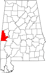 | |
| Towns | ||
| CDPs | ||
| Unincorporated communities | ||