Crookston, Nebraska
| Crookston, Nebraska | |
|---|---|
| Village | |
|
Approaching Crookston from the south via county road | |
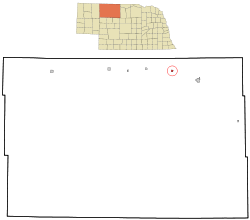 Location of Crookston, Nebraska | |
| Coordinates: 42°55′39″N 100°45′9″W / 42.92750°N 100.75250°WCoordinates: 42°55′39″N 100°45′9″W / 42.92750°N 100.75250°W | |
| Country | United States |
| State | Nebraska |
| County | Cherry |
| Area[1] | |
| • Total | 0.44 sq mi (1.14 km2) |
| • Land | 0.44 sq mi (1.14 km2) |
| • Water | 0 sq mi (0 km2) |
| Elevation | 2,697 ft (822 m) |
| Population (2010)[2] | |
| • Total | 69 |
| • Estimate (2012[3]) | 69 |
| • Density | 156.8/sq mi (60.5/km2) |
| Time zone | Mountain (MST) (UTC-7) |
| • Summer (DST) | MDT (UTC-6) |
| ZIP code | 69212 |
| Area code(s) | 402 |
| FIPS code | 31-11475[4] |
| GNIS feature ID | 0828478[5] |

Crookston is a village in Cherry County, Nebraska, United States. The population was 69 at the 2010 census.
History
Crookston had its start in the year 1885 by the building of the railroad through that territory.[6] It was named for W. T. Crook, a railroad official.[7][8]
A post office was established in Crookston in 1886,[9] and remains in operation.[10]
Geography
Crookston is located at 42°55′39″N 100°45′9″W / 42.92750°N 100.75250°W (42.927366, -100.752481).[11]
According to the United States Census Bureau, the village has a total area of 0.44 square miles (1.14 km2), all of it land.[1]
Demographics
| Historical population | |||
|---|---|---|---|
| Census | Pop. | %± | |
| 1930 | 373 | — | |
| 1940 | 262 | −29.8% | |
| 1950 | 168 | −35.9% | |
| 1960 | 139 | −17.3% | |
| 1970 | 86 | −38.1% | |
| 1980 | 86 | 0.0% | |
| 1990 | 99 | 15.1% | |
| 2000 | 98 | −1.0% | |
| 2010 | 69 | −29.6% | |
| Est. 2015 | 70 | [12] | 1.4% |
2010 census
As of the census[2] of 2010, there were 69 people, 35 households, and 17 families residing in the village. The population density was 156.8 inhabitants per square mile (60.5/km2). There were 51 housing units at an average density of 115.9 per square mile (44.7/km2). The racial makeup of the village was 89.9% White, 2.9% Native American, 1.4% Pacific Islander, and 5.8% from two or more races.
There were 35 households of which 25.7% had children under the age of 18 living with them, 40.0% were married couples living together, 5.7% had a female householder with no husband present, 2.9% had a male householder with no wife present, and 51.4% were non-families. 51.4% of all households were made up of individuals and 14.3% had someone living alone who was 65 years of age or older. The average household size was 1.97 and the average family size was 2.88.
The median age in the village was 45.8 years. 24.6% of residents were under the age of 18; 7.1% were between the ages of 18 and 24; 15.9% were from 25 to 44; 39% were from 45 to 64; and 13% were 65 years of age or older. The gender makeup of the village was 55.1% male and 44.9% female.
2000 census
As of the census[4] of 2000, there were 98 people, 40 households, and 23 families residing in the village. The population density was 229.9 people per square mile (88.0/km²). There were 48 housing units at an average density of 112.6 per square mile (43.1/km²). The racial makeup of the village was 95.92% White, and 4.08% from two or more races.
There were 40 households out of which 27.5% had children under the age of 18 living with them, 40.0% were married couples living together, 7.5% had a female householder with no husband present, and 42.5% were non-families. 27.5% of all households were made up of individuals and 5.0% had someone living alone who was 65 years of age or older. The average household size was 2.45 and the average family size was 3.13.
In the village the population was spread out with 25.5% under the age of 18, 7.1% from 18 to 24, 31.6% from 25 to 44, 28.6% from 45 to 64, and 7.1% who were 65 years of age or older. The median age was 37 years. For every 100 females there were 117.8 males. For every 100 females age 18 and over, there were 102.8 males.
As of 2000 the median income for a household in the village was $27,000, and the median income for a family was $25,833. Males had a median income of $25,000 versus $16,094 for females. The per capita income for the village was $13,945. There were 30.0% of families and 44.8% of the population living below the poverty line, including 64.3% of under eighteens and 100.0% of those over 64.
References
- 1 2 "US Gazetteer files 2010". United States Census Bureau. Archived from the original on January 24, 2012. Retrieved 2012-06-24.
- 1 2 "American FactFinder". United States Census Bureau. Retrieved 2012-06-24.
- ↑ "Population Estimates". United States Census Bureau. Archived from the original on June 17, 2013. Retrieved 2013-05-29.
- 1 2 "American FactFinder". United States Census Bureau. Archived from the original on September 11, 2013. Retrieved 2008-01-31.
- ↑ "US Board on Geographic Names". United States Geological Survey. 2007-10-25. Retrieved 2008-01-31.
- ↑ "Crookston, Cherry County". Center for Advanced Land Management Information Technologies. University of Nebraska. Retrieved 2 August 2014.
- ↑ Fitzpatrick, Lillian L. (1960). Nebraska Place-Names. University of Nebraska Press. p. 37.
- ↑ Company, Chicago and North Western Railway (1908). A History of the Origin of the Place Names Connected with the Chicago & North Western and Chicago, St. Paul, Minneapolis & Omaha Railways. p. 61.
- ↑ "Cherry County". Jim Forte Postal History. Retrieved 25 August 2014.
- ↑ "Find Locations". USPS. Retrieved 6 October 2014.
- ↑ "US Gazetteer files: 2010, 2000, and 1990". United States Census Bureau. 2011-02-12. Retrieved 2011-04-23.
- ↑ "Annual Estimates of the Resident Population for Incorporated Places: April 1, 2010 to July 1, 2015". Retrieved July 2, 2016.
- ↑ "Census of Population and Housing". Census.gov. Archived from the original on May 11, 2015. Retrieved June 4, 2015.
Municipalities and communities of Cherry County, Nebraska, United States | ||
|---|---|---|
| City | ||
| Villages | ||
| CDP | ||
| Other unincorporated communities | ||
| Ghost towns | ||