Croagh
| Croagh, Co Limerick Cróch | |
|---|---|
| Village | |
 | |
 Croagh, Co Limerick Location in Ireland | |
| Coordinates: 52°32′03″N 08°52′14″W / 52.53417°N 8.87056°WCoordinates: 52°32′03″N 08°52′14″W / 52.53417°N 8.87056°W | |
| Country |
|
| Province | Munster |
| County | County Limerick |
| Time zone | WET (UTC+0) |
| • Summer (DST) | IST (WEST) (UTC-1) |
Croagh (Irish: Cróch) is a picturesque small village in County Limerick, Ireland.[1] It is located between Rathkeale and Adare just off the N21 national primary road, 22km (14 miles) south west of Limerick City. The village was originally part of this route before construction of the Croagh by-pass in 1986. "Croagh" derived its name either from the Irish word cruach, which is a hill or mountain, or cróch, which is the Irish for "saffron".
The village is in the agricultural area known as the Golden Vale. The village itself is one of the widest in County Limerick, with a park, monastery, nursing home, music school, restaurant, hostel, garden centre, church, school, shop, two pubs, hall, indoor Gaelic Athletic Association alley and two GAA pitches.
External links
See also
References
- ↑ "Placenames Database of Ireland". Dublin City University. Retrieved 14 November 2014.
Places in County Limerick | ||
|---|---|---|
| Cities | 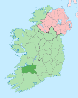 | |
| Towns | ||
| Villages and townlands |
| |
| ||
| Province | |||||||||||||||||||||||||||||||||||
|---|---|---|---|---|---|---|---|---|---|---|---|---|---|---|---|---|---|---|---|---|---|---|---|---|---|---|---|---|---|---|---|---|---|---|---|
| Ordinaries | |||||||||||||||||||||||||||||||||||
| Cathedral church | |||||||||||||||||||||||||||||||||||
| Parishes |
| ||||||||||||||||||||||||||||||||||
| |||||||||||||||||||||||||||||||||||