Clarina Village
This article is about the village in Ireland. For the woodwind instrument, see Heckel-clarina. For the genus of moths, see Clarina (moth).
| Clarina Clár Aidhne | |
|---|---|
| Village | |
 Clarina Location in Ireland | |
| Coordinates: 52°38′02″N 08°43′47″W / 52.63389°N 8.72972°WCoordinates: 52°38′02″N 08°43′47″W / 52.63389°N 8.72972°W | |
| Country |
|
| Province | Munster |
| County | County Limerick |
| Time zone | WET (UTC+0) |
| • Summer (DST) | IST (WEST) (UTC-1) |
Clarina (Irish: Clár Aidhne) is a village in County Limerick in the province of Munster, Ireland.[1] It lies between Mungret and Kildimo on the N69 National Route about 6 miles west of Limerick city close to the River Maigue. The Maigue is a tributary of the River Shannon and enters the Shannon estuary between Limerick city and the mouth of the Deel river, Askeaton, county Limerick.
Clarina is within the Patrickswell-Ballybrown parish. The main area of interest is the nearby location of Carrigogunnell Castle.
Schools
Clarina has a National School called St. Josephs N.S (mixed),[2]
History
Carrigogunnell Castle [3]
See also
References
- ↑ "Placenames Database of Ireland". Dublin City University. Retrieved 13 November 2014.
- ↑ St. Josephs National School Web site
- ↑ Carrigogunnell Castle
External links
Places in County Limerick | ||
|---|---|---|
| Cities | 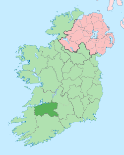 | |
| Towns | ||
| Villages and townlands |
| |
| ||
This article is issued from Wikipedia - version of the 6/7/2016. The text is available under the Creative Commons Attribution/Share Alike but additional terms may apply for the media files.