Cottleville, Missouri
| Cottleville, Missouri | |
|---|---|
| City | |
 Location of Cottleville, Missouri | |
| Coordinates: 38°45′7″N 90°39′12″W / 38.75194°N 90.65333°WCoordinates: 38°45′7″N 90°39′12″W / 38.75194°N 90.65333°W | |
| Country | United States |
| State | Missouri |
| County | St. Charles |
| Area[1] | |
| • Total | 4.46 sq mi (11.55 km2) |
| • Land | 4.46 sq mi (11.55 km2) |
| • Water | 0 sq mi (0 km2) |
| Elevation | 495 ft (151 m) |
| Population (2010)[2] | |
| • Total | 3,075 |
| • Estimate (2012[3]) | 3,523 |
| • Density | 689.5/sq mi (266.2/km2) |
| Time zone | Central (CST) (UTC-6) |
| • Summer (DST) | CDT (UTC-5) |
| FIPS code | 29-16678[4] |
| GNIS feature ID | 0755933[5] |
Cottleville is a city in St. Charles County, Missouri, United States. The population was 3,075 at the 2010 census.
History
Cottleville was laid out in 1839.[6] It was named by and for Captain Alonzo Cottle, an early settler and a veteran of the Black Hawk and Seminole wars.[7][8]
Schools
Cottleville is home to Francis Howell Central High School, Louis C. Saeger Middle School and Warren Elementary School. St. Joseph Catholic School is also located in Cottleville, providing classes for grades K-8; St. Joseph Catholic Church is the largest church by number of parishioners in the Roman Catholic Archdiocese of St. Louis. St. Charles Community College is also located nearby.
Geography
Cottleville is located at 38°45′7″N 90°39′12″W / 38.75194°N 90.65333°W (38.751819, -90.653390).[9] According to the United States Census Bureau, the city has a total area of 4.46 square miles (11.55 km2), all of it land.[1]
Demographics
| Historical population | |||
|---|---|---|---|
| Census | Pop. | %± | |
| 1880 | 225 | — | |
| 1970 | 230 | — | |
| 1980 | 184 | −20.0% | |
| 1990 | 2,936 | 1,495.7% | |
| 2000 | 1,928 | −34.3% | |
| 2010 | 3,075 | 59.5% | |
| Est. 2015 | 4,723 | [10] | 53.6% |
2010 census
As of the census[2] of 2010, there were 3,075 people, 1,020 households, and 847 families residing in the city. The population density was 689.5 inhabitants per square mile (266.2/km2). There were 1,145 housing units at an average density of 256.7 per square mile (99.1/km2). The racial makeup of the city was 92.7% White, 3.7% African American, 0.2% Native American, 1.5% Asian, 0.5% from other races, and 1.4% from two or more races. Hispanic or Latino of any race were 1.8% of the population.
There were 1,020 households of which 45.5% had children under the age of 18 living with them, 71.3% were married couples living together, 8.0% had a female householder with no husband present, 3.7% had a male householder with no wife present, and 17.0% were non-families. 13.3% of all households were made up of individuals and 3.6% had someone living alone who was 65 years of age or older. The average household size was 3.01 and the average family size was 3.31.
The median age in the city was 38.2 years. 29.4% of residents were under the age of 18; 7.3% were between the ages of 18 and 24; 25.1% were from 25 to 44; 30.3% were from 45 to 64; and 7.8% were 65 years of age or older. The gender makeup of the city was 50.0% male and 50.0% female.
2000 census
As of the census[4] of 2000, there were 1,928 people, 600 households, and 526 families residing in the city. The population density was 493.7 people per square mile (190.4/km²). There were 616 housing units at an average density of 157.7 per square mile (60.8/km²). The racial makeup of the city was 96.27% White, 1.97% African American, 0.57% Asian, 0.26% from other races, and 0.93% from two or more races. Hispanic or Latino of any race were 0.88% of the population.
There were 600 households out of which 56.0% had children under the age of 18 living with them, 79.3% were married couples living together, 5.7% had a female householder with no husband present, and 12.2% were non-families. 8.2% of all households were made up of individuals and 2.2% had someone living alone who was 65 years of age or older. The average household size was 3.20 and the average family size was 3.41.
In the city the population was spread out with 35.2% under the age of 18, 5.4% from 18 to 24, 38.8% from 25 to 44, 17.1% from 45 to 64, and 3.5% who were 65 years of age or older. The median age was 31 years. For every 100 females there were 99.2 males. For every 100 females age 18 and over, there were 99.4 males.
The median income for a household in the city was $74,200, and the median income for a family was $78,017. Males had a median income of $48,714 versus $35,000 for females. The per capita income for the city was $26,729. About 1.5% of families and 1.7% of the population were below the poverty line, including 3.0% of those under age 18 and none of those age 65 or over.
References
- 1 2 "US Gazetteer files 2010". United States Census Bureau. Archived from the original on 2012-07-14. Retrieved 2012-07-08.
- 1 2 "American FactFinder". United States Census Bureau. Retrieved 2012-07-08.
- ↑ "Population Estimates". United States Census Bureau. Archived from the original on 2013-06-17. Retrieved 2013-05-30.
- 1 2 "American FactFinder". United States Census Bureau. Archived from the original on 2013-09-11. Retrieved 2008-01-31.
- ↑ "US Board on Geographic Names". United States Geological Survey. 2007-10-25. Retrieved 2008-01-31.
- ↑ Eaton, David Wolfe (1917). How Missouri Counties, Towns and Streams Were Named. The State Historical Society of Missouri. p. 355.
- ↑ Gannett, Henry (1905). The Origin of Certain Place Names in the United States. Govt. Print. Off. p. 93.
- ↑ Eaton, David Wolfe (1917). How Missouri Counties, Towns and Streams Were Named. The State Historical Society of Missouri. p. 355.
- ↑ "US Gazetteer files: 2010, 2000, and 1990". United States Census Bureau. 2011-02-12. Retrieved 2011-04-23.
- ↑ "Annual Estimates of the Resident Population for Incorporated Places: April 1, 2010 to July 1, 2015". Retrieved July 2, 2016.
- ↑ "Census of Population and Housing". Census.gov. Archived from the original on May 11, 2015. Retrieved June 4, 2015.
External links
Municipalities and communities of St. Charles County, Missouri, United States | ||
|---|---|---|
| Cities | 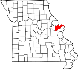 | |
| Villages | ||
| Townships |
| |
| CDP | ||
| Other unincorporated communities |
| |
| Footnotes | ‡This populated place also has portions in an adjacent county or counties | |