Cosalá
| Cosalá | ||
|---|---|---|
| ||
|
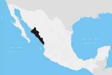
Cosalá Location in Mexico | ||
| Coordinates: 24°24′45″N 106°41′30″W / 24.41250°N 106.69167°WCoordinates: 24°24′45″N 106°41′30″W / 24.41250°N 106.69167°W | ||
| Country |
| |
| State | Sinaloa | |
| Municipality | Cosalá | |
| Government | ||
| • Municipal president | Mario Padilla (PRI) | |
| Elevation | 380 m (1,250 ft) | |
| Population (2010) | ||
| • Total | 6,577 | |
| [1] | ||
| Time zone | Mountain Standard Time (UTC-7) | |
| • Summer (DST) | Mountain Daylight Time (UTC-6) | |
| Website | Cosalá Government page | |

Cosalá (Spanish ![]() [kosala'] is a small city and the seat of its surrounding municipality in the Mexican
state of Sinaloa. It stands at
24°24′45″N 106°41′30″W / 24.41250°N 106.69167°W.
The city reported 6,577 inhabitants in the 2010 census.[1]
[kosala'] is a small city and the seat of its surrounding municipality in the Mexican
state of Sinaloa. It stands at
24°24′45″N 106°41′30″W / 24.41250°N 106.69167°W.
The city reported 6,577 inhabitants in the 2010 census.[1]
Overview
Cosala is located 155 km. from state capital Culiacán. The Royal of the Eleven Thousand Virgins, shortened its name to the Royal Mines of Cosala is the municipal seat and without doubt one of the most beautiful villages of the state, keeping a quiet atmosphere that seem like you are in a story book. As if history had stopped in the times of the Spaniards. Every little street is a delight. One would want to stay at least a couple of days in Cosala.
Francisco Iriarte y Conde, governor of Occidente State declared Cosala the capital of the western state in 1826. This was due to the growing threat of attack on the former capital El Fuerte, Sinaloa by the forces of Juan Banderas, leader of the Yaqui at that point in the Yaqui Wars.[2]
Iriarte introduced printing in the Sonora and Sinaloa and it was in Cosala that the first newspaper of Sinaloa, "The Impartial Spectator" was published.
In its surroundings there are attractive places as the Vado Hondo waterfall and town reservoirs "Comedero" and "El Salto" a few miles from town. Both these lakes are stocked with largemouth bass. The museum of Mineralogy is highly interesting, it mainly displays photographs and documents on the history of mining in Sinaloa.
Cosala was the dominant region in the social and political life of the State of Sinaloa until it became its capital in the early independent Mexico.
Climate
Cosalá is classified as having a Köppen Tropical Wet and Dry (Aw) Climate, despite being situated about 1 degree above the Tropic of Cancer. Most municipalities to the north of Cosalá, such as Culiacán, have semi-arid to arid climates, as one moves towards the Sonoran-Sinaloan Transitional Subtropical Forests, and into the Sonoran Desert.
Cosalá experiences much greater diurnal temperature variations than most Tropical Wet and Dry climates, especially during the winter months, where temperatures regularly drop as low as 10C in January and February (compare this to Mazatlán, located about 1 degree south, inside the Tropic of Cancer, where nighttime temperatures in January and February are about 15C on average). Daytime temperatures also tend to be hotter than most locations further south (highs approaching 37C in May/Jun, compared to 30C-33C for Mazatlán), and as such, Cosala's climate behaves more similarly to a semi-arid climate, in this regard, than a truly tropical climate. The record low temperature of 1C, is also substantially colder than Mazatlan's 7.5C.
| Climate data for Cosala (1951–2010) | |||||||||||||
|---|---|---|---|---|---|---|---|---|---|---|---|---|---|
| Month | Jan | Feb | Mar | Apr | May | Jun | Jul | Aug | Sep | Oct | Nov | Dec | Year |
| Record high °C (°F) | 44.0 (111.2) |
42.0 (107.6) |
44.0 (111.2) |
43.0 (109.4) |
43.0 (109.4) |
43.0 (109.4) |
41.0 (105.8) |
40.0 (104) |
40.0 (104) |
45.0 (113) |
43.0 (109.4) |
43.0 (109.4) |
45.0 (113) |
| Average high °C (°F) | 28.1 (82.6) |
30.2 (86.4) |
32.9 (91.2) |
35.6 (96.1) |
37.3 (99.1) |
36.5 (97.7) |
33.8 (92.8) |
33.2 (91.8) |
32.9 (91.2) |
32.9 (91.2) |
31.3 (88.3) |
28.3 (82.9) |
32.8 (91) |
| Daily mean °C (°F) | 19.3 (66.7) |
20.3 (68.5) |
22.2 (72) |
24.9 (76.8) |
27.3 (81.1) |
29.4 (84.9) |
28.2 (82.8) |
27.8 (82) |
27.5 (81.5) |
26.0 (78.8) |
22.5 (72.5) |
20.0 (68) |
24.6 (76.3) |
| Average low °C (°F) | 10.4 (50.7) |
10.4 (50.7) |
11.6 (52.9) |
14.3 (57.7) |
17.3 (63.1) |
22.2 (72) |
22.7 (72.9) |
22.4 (72.3) |
22.2 (72) |
19.1 (66.4) |
13.7 (56.7) |
11.6 (52.9) |
16.5 (61.7) |
| Record low °C (°F) | 3.0 (37.4) |
1.0 (33.8) |
3.0 (37.4) |
4.0 (39.2) |
9.0 (48.2) |
15.0 (59) |
15.0 (59) |
15.0 (59) |
13.5 (56.3) |
5.0 (41) |
4.0 (39.2) |
3.0 (37.4) |
1.0 (33.8) |
| Average precipitation mm (inches) | 24.6 (0.969) |
13.9 (0.547) |
10.3 (0.406) |
5.1 (0.201) |
5.4 (0.213) |
117.7 (4.634) |
293.3 (11.547) |
257.6 (10.142) |
185.5 (7.303) |
84.2 (3.315) |
34.1 (1.343) |
52.0 (2.047) |
1,083.7 (42.665) |
| Average precipitation days (≥ 0.1 mm) | 2.0 | 1.1 | 0.8 | 0.4 | 0.4 | 5.3 | 17.6 | 16.3 | 11.8 | 3.6 | 1.7 | 3.3 | 64.3 |
| Source: Servicio Meteorologico Nacional[3][4] | |||||||||||||
Main sights
Cosala is a picturesque colonial town surrounded by myriad of natural attractions.
Among the major places to enjoy in the surrounding area are:
- The Vado Hondo Resort, located fifteen kilometers from Cosala
- The Caudal del Arroyo del Sabinal which has a large natural pool with three waterfalls that make it a perfect place for picnics
- The Gruta Mexico, a giant cave with beautiful stalactites and stalagmites
- The Santa Ursula Temple, built in the 18th century which represents the most significative church of Cosala
- The Museum of Mining and History, unique in the country because it traces the mining history of the State with collections of:
- documents
- old photographs
- pre-Hispanic and colonial metallic objects
- mineral samples
- books
- weapons
- carriages and horseshoes from the 18th and 19th centuries
Cosalá, Sinaloa, was named a "Pueblo Mágico" in 2005 for its natural beauty, cultural riches, & historical relevance.
External links
- http://www.sinaloa.gob.mx/conociendo/municipios/cosala.htm
- http://www.tourbymexico.com/sinaloa/cosala/cosala.htm
- http://www.cosala-sinaloa.com/
- 1 2 "Principales resultados por localidad 2010 (ITER)". Instituto Nacional de Estadística y Geografía. 2010.
- ↑ Edward H. Spicer, Cycles of Conquest (Tucson: University of Arizona Press, 1962) p. 60
- ↑ "Estado de Sinaloa-Estacion: Cosalá". Normales Climatologicas 1951–2010 (in Spanish). Servicio Meteorologico Nacional. Retrieved 20 April 2015.
- ↑ "Extreme Temperatures and Precipitation for Cosalá 1908–1988" (in Spanish). Servicio Meteorológico Nacional. Retrieved 20 April 2015.