Copley Township, Knox County, Illinois
| Copley Township | |
|---|---|
| Township | |
 Location in Knox County | |
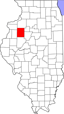 Knox County's location in Illinois | |
| Coordinates: 41°01′09″N 90°09′20″W / 41.01917°N 90.15556°WCoordinates: 41°01′09″N 90°09′20″W / 41.01917°N 90.15556°W | |
| Country |
|
| State |
|
| County | Knox |
| Established | November 2, 1852 |
| Area | |
| • Total | 35.47 sq mi (91.9 km2) |
| • Land | 35.04 sq mi (90.8 km2) |
| • Water | 0.43 sq mi (1.1 km2) 1.21% |
| Elevation | 810 ft (247 m) |
| Population (2010) | |
| • Total | 348 |
| • Density | 9.9/sq mi (3.8/km2) |
| Time zone | CST (UTC-6) |
| • Summer (DST) | CDT (UTC-5) |
| ZIP codes | 61414, 61428, 61448, 61467, 61485 |
| GNIS feature ID | 0428842 |
Copley Township is one of twenty-one townships in Knox County, Illinois, USA. As of the 2010 census, its population was 348 and it contained 235 housing units.[1] In the 1850 report, the township was named Prince Albert Township. It was later named Richfield Township, and the name was changed to Copley Township on June 8, 1853.
Geography
According to the 2010 census, the township has a total area of 35.47 square miles (91.9 km2), of which 35.04 square miles (90.8 km2) (or 98.79%) is land and 0.43 square miles (1.1 km2) (or 1.21%) is water.[1]
Cities, towns, villages
- Victoria (west half)
Cemeteries
The township contains these four cemeteries: Martin, Old Scotch, Smith and Westfall.
Lakes
- Corn Crib Lake
- Little John Club Lake
- Long Lake
- Manson Heights Lake
- North Lake
- Peterson Lake
- Roundhouse Lake
- Skender Lake
- South Lake
School districts
- Rowva Community Unit School District 208
Political districts
- Illinois's 18th congressional district
- State House District 74
- State Senate District 37
References
- "Copley Township, Knox County, Illinois". Geographic Names Information System. United States Geological Survey. Retrieved 2010-02-25.
- United States Census Bureau 2009 TIGER/Line Shapefiles
- United States National Atlas
- 1 2 "Population, Housing Units, Area, and Density: 2010 - County -- County Subdivision and Place -- 2010 Census Summary File 1". United States Census. Retrieved 2013-05-28.
External links
 |
Ontario Township | Walnut Grove Township | Lynn Township | |
| Sparta Township | |
Victoria Township | ||
| ||||
| | ||||
| Knox Township | Persifer Township | Truro Township |
Municipalities and communities of Knox County, Illinois, United States | ||
|---|---|---|
| Cities | ||
| Villages | ||
| Townships | ||
| CDPs | ||
| Other unincorporated communities | ||
| Ghost towns | ||
| Footnotes | ‡This populated place also has portions in an adjacent county or counties | |
This article is issued from Wikipedia - version of the 11/30/2016. The text is available under the Creative Commons Attribution/Share Alike but additional terms may apply for the media files.