Coomandook
| Coomandook South Australia | |
|---|---|
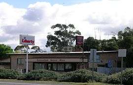 The general store and bottle shop at Coomandook. | |
 Coomandook | |
| Coordinates | 35°28′09″S 139°41′56″E / 35.4693°S 139.6990°ECoordinates: 35°28′09″S 139°41′56″E / 35.4693°S 139.6990°E |
| Postcode(s) | 5261 |
| Elevation | 16 m (52 ft) |
| Location | 120 km (75 mi) SE of Adelaide |
| LGA(s) | Coorong District Council |
| State electorate(s) | MacKillop |
| Federal Division(s) | Barker |
Coomandook is a settlement about 120 kilometres (75 mi) east-south-east of Adelaide on Dukes Highway in South Australia.[1] The nearest place with a larger population is Coonalpyn, which is 29 kilometres (18 mi) away, with a population of around 230.
Coomandook is near the edge of the vast mallee scrub area which stretches from western Victoria across into the south east of South Australia. The most common agricultural industries are sheep, beef cattle rearing and grain growing.
The population of Coomandook was not recorded under that name in the 2006 census, but 134 voters cast their votes in Coomandook during the 2010 Barker division election.[2]
References
- ↑ "2905.0 - Statistical Geography: Volume 2 -- Census Geographic Areas, Australia, 2006". Australian Bureau of Statistics. Retrieved 8 December 2009.
- ↑ "POLLING PLACE - COOMANDOOK". Election 2010. Retrieved 20 May 2011.
This article is issued from Wikipedia - version of the 11/14/2014. The text is available under the Creative Commons Attribution/Share Alike but additional terms may apply for the media files.