Colonia del Valle
| Colonia del Valle | |
|---|---|
| Neighborhood of Benito Juárez | |
|
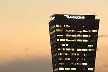
Panoramic view of north section of Del Valle | |
 Colonia del Valle location in southcenter Mexico City | |
| Coordinates: MX 19°23′21″N 99°10′04″W / 19.389164°N 99.167668°W | |
| Country | Mexico |
| State | Federal district |
| City | Mexico City |
| Borough | Benito Juárez |


Colonia del Valle (Spanish for: Del Valle neighborhood) is an area of Benito Juarez borough in Mexico City, consisting of three official areas, Norte, Centro and Sur, and small surrounding neighborhoods.
Its inhabitants belong mostly to the upper and upper-middle class of the capital, home to many parks, wide tree-lined streets, luxurious shops and some monuments of the city. It is an area with an important infrastructure, including communications, transport and urban services of all kinds, and it is considered one of the landmarks of the city.[1]
Since 2013 it has been listed, by Mexican financial media, as one of the areas with highest housing costs in the country.[2][3]
History
At the beginning of the 20th century the ranches cultivated with alfalfa and fruit trees were divided, giving rise to Colonia Americana. Some neighborhood streets are named after these ranches and their fruit trees, others after Mexican philanthropists.
While serving as a streetcar route from Mexico City to Coyoacán it developed slowly until 1920, when it expanded and the Avenida de los Insurgentes was paved. Large-scale home and mansion construction started. The area also featured monument construction and green areas; one is the Paque Hundido, built on a former sand mine.
In the 1960s the area was as fully developed as many other neighborhoods of equal purchasing power on its borders. Commercial development included two major facilities, Liverpool Insurgentes opening in 1962 and the country's first shopping center, University Plaza, in 1969.
In 1978 the city built the Ejes viales, a system of wide, one-way roads criss-crossing the city, and with this Del Valle was transformed radically and permanently, its tree-lined boulevards with green medians transformed into quasi-freeways. Ejes 4, 5, 6, 7 and 8 south crossed from east to west and 1, 2 and 3 from south to north. This drove many families to look for a quieter place to live and began the process of redeveloping the area. Mansions were replaced by apartment buildings, offices or schools.
Crime statistics from 2009 showed that Colonia del Valle was the second most crime-ridden neighborhood in Mexico City, sharing the top 10 list with notorious neighborhoods Tepito and Colonia Doctores.[4] However, 2012 statistics do not place Del Valle on the list of the top 6 most crime-ridden neighborhoods.[5]
Transportation
Major roads running through the neighborhood include: Insurgentes, Cuauhtemoc, Northern Division, University, Félix Cuevas, José María Rico, Xola. Mexico City Metro Line 3 has several stations in the vicinity: Etiopía, Eugenia, División del Norte, Zapata and Coyoacán. Mexico City Metrobús (BRT) Line 3 stops at Amores (corner of Xola).
Architecture
The architecture includes large mansions in Californian mission revival Art Deco style and, to a lesser extent, surviving examples of Porfiriato. At the end of the 1960s many small skyscrapers, both commercial and residential, were built, making the area one of the most densely populated of Mexico City. Housing complexes were also built.
It houses churches such as the Temple of the Immaculate Heart of Mary, and buildings dating from the period of colonization and conquest between park Tlacoquemécatl including the Temple of San Lorenzo and the Xochimanca, cultural areas and parks like the Sunken Park or Mariscal Sucre Park, the French Kiosk, art galleries, libraries, auditoriums Polyforum Cultural Siqueiros, Plaza México, and Estadio Azul stadium.
Religious buildings
The religious structures found in the Del Valle include the Templo del Purísimo Corazón de María (Parish of the Most Pure Heart of Mary) at the corner of Gabriel Mancera number 415. It was built in the early 20th century. In 1996 several scenes of the film Romeo + Juliet were filmed at the church. Mexican singer Luis Miguel was baptized there.
The Temple of San Lorenzo Xochimanca, located in the park of the same name a.k.a. Parque Popular, was built in the 16th century.[6]
The Parroquia del Señor del Buen Despacho, located in Parque Tlacoquemécatl, dates from the 18th century.[7] The Temple of Santo Tomás Actipan, built in 1897, is located at the corner of Bufalo and Tigre streets.
The Temple of Santa Monica, with the signature "cáscaro" thin-shell structure of its architect Félix Candela, on Fresa Street opposite the park of San Lorenzo, was built in 1962. The Parish of Divine Providence in Adolfo Prieto street was constructed between 1968 and 1974.
Education
Within the Del Valle are two of the oldest educational institutions in the country; the College and Institute of Mexico and its Centro Universitario Mexico, and the Colegio Simón Bolívar. Graduates of these schools include Octavio Paz and Germán Dehesa.
International schools include:
- Colegio Suizo de México (Schweizerschule Mexiko)[8]
Other private schools:
- Tomás Alva Edison School[9]
- Escuela Mexicana del Valle / Americana
- Escuela Sierra Nevada - Centro Educativo Nemi[10]
- Colegio Nuevo Continente - Campus Ciudad de México[11]
References
- ↑ http://www.ciudadmexico.com.mx/zonas/colonia_del_valle.htm
- ↑ http://www.elfinanciero.com.mx/economia/cuales-son-las-colonias-con-mayor-plusvalia-en-el-pais.html
- ↑ http://www.metroscubicos.com/articulo/guia-de-precios/2012/08/13/colonias-con-mayor-plusvala-para-2012 |título=Colonias con más plusvalía durante el 2013
- ↑ Ledezma, Hector (April 3, 2009). "Del Valle, de las 10 colonias más inseguras del DF" [Del Valle, one of the 10 most unsafe colonias in Mexico City] (in Spanish). Retrieved 12 May 2012.
- ↑ Miguel Á. Morales (2013-07-08), "Las 6 zonas más inseguras del DF" [The 6 most unsafe areas in Mexico City], Más por Más (in Spanish), retrieved 2013-10-07
- ↑ http://www.ciudadmexico.com.mx/atractivos/templo_%20de_%20san_%20lorenzo.htm
- ↑ "Parroquia del Señor del Buen Despacho", SECTUR DF
- ↑ "Contact." Colegio Suizo de México. Retrieved on 14 March 2014. "CAMPUS MÉXICO El Colegio Europeo en la Colonia del Valle Nicolás San Juan 917 Col. Del Valle C.P. 03100, México D.F." and "CAMPUS CUERNAVACA El Colegio Europeo en Cuernavaca Calle Amates s/n Col. Lomas de Ahuatlán C.P. 62130 , Cuernavaca, Morelos." and "CAMPUS QUERÉTARO El Colegio Europeo en Querétaro Circuito la Cima No. 901 Fracc. La Cima C.P. 76146 , Querétaro, Querétaro"
- ↑ "TAE Profile." Tomás Alva Edison School. p. 4. Retrieved on April 14, 2016. "Preschool Heriberto Frías 1407 Colonia del Valle México, D.F., C.P. 03100" and "Elementary School Manzanas 11 Colonia del Valle México, D.F., C.P. 03100" and "Middle School Amores 1213 Colonia del Valle México, D.F., C.P. 03100" and "High School Heriberto Frías 1401 Colonia del Valle México, D.F., C.P. 03100"
- ↑ "Contact." Escuela Sierra Nevada. Retrieved on April 5, 2016. "Centro Educativo Nemi Gabriel Mancera 733, Col. del Valle, Benito Juárez México D.F. CP 03810 "
- ↑ "Inicio." Colegio Nuevo Continente. Retrieved on April 20, 2016. "Nicolás San Juan No. 1141, Col. Del Valle, México DF. CP. 03100"
External links
| Wikivoyage has a travel guide for Mexico City/Del Valle. |
- Colonia del Valle on the Internet (Spanish)
Coordinates: 19°23′21″N 99°10′04″W / 19.389164°N 99.167668°W