Colcabamba District, Tayacaja
| Colcabamba Qullqapampa | ||
|---|---|---|
| District | ||
|
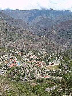
Campo Armiño, Colcabamba District | ||
| ||
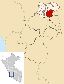 Location of Colcabamba in the Tayacaja province | ||
| Coordinates: 12°24.5′S 74°40.6′W / 12.4083°S 74.6767°WCoordinates: 12°24.5′S 74°40.6′W / 12.4083°S 74.6767°W | ||
| Country |
| |
| Region | Huancavelica | |
| Province | Tayacaja | |
| Capital | Colcabamba | |
| Government | ||
| • Mayor | Augusto Maravi Romani | |
| Area | ||
| • Total | 598.12 km2 (230.94 sq mi) | |
| Elevation | 2,979 m (9,774 ft) | |
| Population (2005 census) | ||
| • Total | 21,593 | |
| • Density | 36/km2 (94/sq mi) | |
| Time zone | PET (UTC-5) | |
| UBIGEO | 090705 | |
Colcabamba District is one of sixteen districts of the province Tayacaja in Peru.[1]
Ethnic groups
The people in the district are mainly indigenous citizens of Quechua descent. Quechua is the language which the majority of the population (76.32%) learnt to speak in childhood, 23.21% of the residents started speaking using the Spanish language (2007 Peru Census).[2]
See also
References
- ↑ (Spanish) Instituto Nacional de Estadística e Informática. Banco de Información Distrital Archived April 23, 2008, at the Wayback Machine.. Retrieved April 11, 2008.
- ↑ inei.gob.pe Archived January 27, 2013, at the Wayback Machine. INEI, Peru, Censos Nacionales 2007, Frequencias: Preguntas de Población: Idioma o lengua con el que aprendió hablar (in Spanish)
| |
|---|---|
| Acobamba | |
| Angaraes | |
| Castrovirreyna | |
| Churcampa | |
| Huancavelica | |
| Huaytará | |
| Tayacaja | |
This article is issued from Wikipedia - version of the 11/27/2016. The text is available under the Creative Commons Attribution/Share Alike but additional terms may apply for the media files.