Clinton Downtown Historic District (Clinton, Michigan)
|
Clinton Downtown Historic District | |
 | |
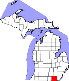
  Location within the state of Michigan | |
| Location | Clinton, Michigan |
|---|---|
| Coordinates | 42°04′19″N 83°58′21″W / 42.07194°N 83.97250°WCoordinates: 42°04′19″N 83°58′21″W / 42.07194°N 83.97250°W |
| NRHP Reference # | 10000220[1] |
| Added to NRHP | April 27, 2010 |
The Clinton Downtown Historic District is a historic district located in the village of Clinton in Clinton Charter Township in the northernmost portion of Lenawee County, Michigan. The district was added to the National Register of Historic Places on April 27, 2010. It is the newest such listing for Lenawee County.[1]
While little has been published on the new listing, the district traces its origin back to the village's incorporation in 1837. The district grew due to its location on the Chicago Road and the River Raisin.[2] The district consists of a single stretch of U.S. Route 12, known locally as West Michigan Avenue, in downtown Clinton. The district also includes Memorial Park, which is a cemetery located a few blocks north of the downtown area.[1]
References
- 1 2 3 "National Register Information System". National Register of Historic Places. National Park Service. November 11, 2009.
- ↑ Village of Clinton (2010). "Village of Clinton: Community History". Retrieved June 7, 2010.
| Topics | |
|---|---|
| Lists by states |
|
| Lists by insular areas | |
| Lists by associated states | |
| Other areas | |
| |