Clavering Island
| Clavering Ø Nickname: Eskimonæs | |
|---|---|
 Map drawn during Lauge Koch's expedition 1931-1934 | |
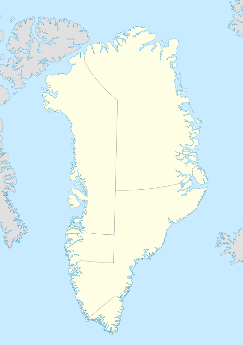 Clavering Island Clavering Island (Greenland) | |
| Geography | |
| Location | East-Greenland |
| Coordinates | 74°16′N 21°00′W / 74.267°N 21.000°WCoordinates: 74°16′N 21°00′W / 74.267°N 21.000°W |
| Area | 1,535 km2 (593 sq mi) |
| Highest elevation | 1,650 m (5,410 ft) |
| Highest point | Ortlerspids |
| Administration | |
|
Greenland | |
| Northeast Greenland National Park | |
| Demographics | |
| Population | 0 |
Clavering Island (Danish: Clavering Ø) is a large island in eastern Greenland off Gael Hamkes Bay, to the south of Wollaston Foreland.
The Eskimonaes (Eskimonæs) radio and weather station was on this island. It was manned by Danish staff and was captured by German troops in 1943. The place where the station stood had also been the location of the last Inuit settlement in Northeast Greenland around 1823.[1]
History
The island was named by the second German North Polar Expedition 1869–70 as Clavering Insel to commemorate Douglas Charles Clavering (1794–1827), commander of the Griper on the 1823 voyage, which explored the area and, at the southern shore of this island made the first (and last) encounter that Europeans made with the now extinct Northeast-Greenland Inuit.
In late August 1823, Clavering and the crew of the Griper encountered a band of twelve Inuit, including men, women and children. In his journal, Clavering described their seal-skin tent, canoe, and clothes, their harpoons and spear tipped with bone and meteoric iron, and their physical appearance ("tawny coppery" skin, "black hair and round visages; their hands and feet very fleshy, and much swelled"). He remarked on their skill in skinning a seal, the custom of sprinkling water over a seal or walrus before skinning, and their amazement at the demonstration of firearms for hunting.[2]
European visitors to Northeast Greenland prior to 1823 reported evidence of extensive Inuit settlement in the region although they encountered no humans. Later expeditions, starting with the Second German North Polar Expedition in 1869, found the remains of many former settlements, but the population had apparently died out during the intervening years.[3]
Bones of muskoxen have been found at Inuit sites on the island, but no such animals were reported by Clavering in 1823. Large numbers of Arctic hare bones suggest that the Inuit were reduced to hunting smaller game after the extinction of muskoxen in the area. After humans died out, muskoxen returned, and the first pair of live muskoxen ever to be brought to Europe were captured at Clavering Island in 1899.[4][5]
Eskimonaes
The Eskimonaes radio and telegraph station stood on a small peninsula in the south coast of Clavering Island. The place had been named Eskimonæsset the 1929-30 Expedition to East Greenland led by Lauge Koch after the abandoned Inuit settlement of four houses of which two were excavated back then. The station was built as a scientific post and was also used later as a base by the Three-year Expedition to East Greenland, as well as by other scientists from 1931 to 1939. From 1941 to 1943 it became the headquarters of the Danish North-East Greenland Sledge Patrol[6]
During the war the code name used for the Eskimonæs Station by the US Coast Guard was 'Bluie East Five' —the same code name would be later used for Myggbukta after Eskimonæs was destroyed. The main building at Eskimonaes was damaged by a German military patrol on 13 March 1943 and the site was bombed by the US Air Force on 14 May the same year. The burnt out station would be replaced by Dødemandsbugten Station, also known as Ny Station, which was built nearby further to the east later in the same year. Dødemandsbugten would be succeeded in 1944 by Daneborg and the ruins of the two former stations lay now abandoned and remain essentially undisturbed as a conspicuous memorial to war-time events. The efforts of the North-East Greenland Sledge Patrol led by Ib Poulson in World War II were chronicled after the war by English author David Armine Howarth in his 1951 book The Sledge Patrol.[7]
Geography
Clavering Island is a coastal island, separated from the mainland by a narrow sound of the Greenland Sea. Its highest point is the 1650 m high Ortlerspids and the island has an area of 1,534.6 km2 (592.5 sq mi) and a shoreline of 165.4 km (102.8 mi).[8] The Halle Range (Hallebjergene) is an up to 1,200-metre-high (3,900 ft) mountain chain on the southwest part of Clavering Island. It was named by Lauge Koch during his 1929–30 expedition.[6] Some small islands are located nearby, such as the Finsch Islands to the south and Jackson Island to the southeast at the mouth of the bay.[9]
 1870 map of the Northern Portion of Eastern Greenland showing coastal islands. |
 Map of the area around Clavering Island. |
See also
Bibliography
- Glob, P.V. 1946: Eskimo settlements in Northeast Greenland. Meddelelser om Grønland 144(6), 40 pp.
References
- ↑ Zabecki, David T. World War II in Europe: An Encyclopedia p. 628
- ↑ Clavering, Douglas Charles (1830). "Journal of a voyage to Spitzbergen and the east coast of Greenland, in His Majesty's ship Griper". Edinburgh New Philosophical Journal. 9: 21–24.
- ↑ Sandell, Hanne Tuborg; Sandell, Birger (1991). "Archaeology and Environment in the Scoresby Sund Fjord". Meddelelser om Grønland Man & Society. Museum Tusculanum Press. 15: 23. Retrieved 15 December 2015.
- ↑ Vibe, Christian (1967). "Arctic Animals in Relation to Climatic Fluctuations". Meddelelser om Grønland. 170: 1–227.
- ↑ Lent, Peter C. (1999). Muskoxen and Their Hunters: A History. Norman, OK: University of Oklahoma Press. pp. 91, 132. ISBN 0-8061-3170-5.
- 1 2 "Catalogue of place names in northern East Greenland" (PDF). Geological Survey of Denmark. Retrieved 8 July 2016.
- ↑ David Howarth, The Sledge Patrol: One of the Greatest Adventure Stories of World War II, (1951)
- ↑ UNEP
- ↑ Shannon Ø
Abandoned sites in Greenland | ||||||||||||||||||||
|---|---|---|---|---|---|---|---|---|---|---|---|---|---|---|---|---|---|---|---|---|
|
|  | ||||||||||||||||||
|
| |||||||||||||||||||
| Polar exploration | ||||||||||||||||||||
| Paleo-Eskimo | ||||||||||||||||||||