City of Mordialloc
| City of Mordialloc Victoria | |||||||||||||
|---|---|---|---|---|---|---|---|---|---|---|---|---|---|
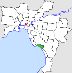 Location in Melbourne | |||||||||||||
| Population | 27,900 (1992)[1] | ||||||||||||
| • Density | 2,056/km2 (5,325/sq mi) | ||||||||||||
| Established | 1920 | ||||||||||||
| Area | 13.57 km2 (5.2 sq mi) | ||||||||||||
| Council seat | Mentone | ||||||||||||
| Region | Melbourne | ||||||||||||
| County | Mornington | ||||||||||||
|
| |||||||||||||
| |||||||||||||
The City of Mordialloc was a local government area about 20 kilometres (12 mi) south of Melbourne, the state capital of Victoria, Australia, on the eastern side of Port Phillip. The city covered an area of 13.57 square kilometres (5.24 sq mi), and existed from 1920 until 1994.
History
Mordialloc was originally part of the Shire of Moorabbin, and was severed and incorporated as the Borough of Mentone and Mordialloc on 26 May 1920. It increased in size on 18 May 1921, by absorbing another small section of Moorabbin. It was declared a town on 17 April 1923 and its name changed to Mordialloc a week later. It was proclaimed a city on 5 May 1926.[2]
On 15 December 1994, the City of Mordialloc was abolished, and, along with the City of Chelsea and parts of the Cities of Moorabbin and Springvale, was merged into the newly created City of Kingston. The eastern section of Beaumaris was transferred to the City of Bayside.[3]
Council meetings were held at the Mentone Town Hall, on Mentone Parade, Mentone. It presently serves as a council service centre and library for the City of Kingston.
Wards
The City of Mordialloc was subdivided into three wards, each electing three councillors:[2]
- Mentone Ward
- Parkdale Ward
- Mordialloc Ward
Suburbs
- Beaumaris (shared with the Cities of Moorabbin and Sandringham)
- Mentone (shared with the City of Moorabbin)
- Mordialloc
- Parkdale
Population
| Year | Population |
|---|---|
| 1933 | 9,216 |
| 1954 | 21,025 |
| 1958 | 24,500* |
| 1961 | 26,526 |
| 1966 | 28,058 |
| 1971 | 29,753 |
| 1976 | 28,615 |
| 1981 | 27,869 |
| 1986 | 26,817 |
| 1991 | 26,325 |
* Estimate in the 1958 Victorian Year Book.
References
- ↑ Australian Bureau of Statistics, Victoria Office (1994). Victorian Year Book. p. 49. ISSN 0067-1223.
- 1 2 Victorian Municipal Directory. Brunswick: Arnall & Jackson. 1992. pp. 430–431. Accessed at State Library of Victoria, La Trobe Reading Room.
- ↑ Australian Bureau of Statistics (1 August 1995). Victorian local government amalgamations 1994-1995: Changes to the Australian Standard Geographical Classification (PDF). Commonwealth of Australia. p. 4,8. ISBN 0-642-23117-6. Retrieved 2007-12-16.
Coordinates: 37°59′S 145°04′E / 37.983°S 145.067°E