Chicken, Alaska
| Chicken, Alaska | |
|---|---|
| CDP | |
|
Downtown Chicken in 2006 | |
 Location of Chicken, Alaska | |
| Coordinates: 64°4′15″N 141°52′30″W / 64.07083°N 141.87500°WCoordinates: 64°4′15″N 141°52′30″W / 64.07083°N 141.87500°W | |
| Country | United States |
| State | Alaska |
| Census Area | Southeast Fairbanks |
| Government | |
| • State senator | Click Bishop (R) |
| • State rep. | Dave Talerico (R) |
| Area | |
| • Total | 115.4 sq mi (298.9 km2) |
| • Land | 115.4 sq mi (298.9 km2) |
| • Water | 0 sq mi (0 km2) |
| Elevation | 1,677 ft (511 m) |
| Population (2010) | |
| • Total | 7 [1] |
| Time zone | Alaska (AKST) (UTC-9) |
| • Summer (DST) | AKDT (UTC-8) |
| ZIP code | 99732 |
| Area code(s) | 907 |
| FIPS code | 02-13450 |
| GNIS feature ID | 1400245 |

Chicken is a census-designated place (CDP) in Southeast Fairbanks Census Area, Alaska, United States. Chicken is a community founded on gold mining and is one of the few surviving gold rush towns in Alaska. The population was 7 at the 2010 Census. However, usually year round, there are 17 inhabitants. Due to mining, Chicken's population peaks during the summer. It has frequently been noted on lists of unusual place names.[2][3]
History
Chicken was settled by gold miners in the late 19th-century and in 1902 the local post office was established requiring a community name. Due to the prevalence of ptarmigan in the area that name was suggested as the official name for the new community. However, the spelling could not be agreed on and Chicken was used to avoid embarrassment.[4] A portion of Chicken, with buildings from the early 1900s and the F.E. Company Dredge No. 4 (Pedro Dredge) are listed on the National Register of Historical Places as the Chicken Historic District. Chicken is the outpost for the 40 Mile mining district. There are still active gold mines in this area. Enough gold was mined here to make it worthwhile to haul huge gold dredges to this remote location. There are still several inactive gold dredges in the Chicken area.
Geography
According to the United States Census Bureau, the CDP has a total area of 115.4 square miles (299 km2), all of it land.
Chicken is accessible by air via Chicken Airport, and by road via Alaska Route 5, the Taylor Highway, which is not maintained from mid-October through mid-March.

References
- ↑ "Archived copy". Archived from the original on 2014-03-05. Retrieved 2011-10-18.
- ↑ Thompson, George E. (2009). You Live Where?: Interesting and Unusual Facts about where We Live. iUniverse. p. 7.
- ↑ Gallant, Frank K. (2012). A Place Called Peculiar: Stories about Unusual American Place-Names. Courier Dover Publications. p. 7.
- ↑ Mackenzie, B. B. (5 June 2012). Alaska Curiosities: Quirky Characters, Roadside Oddities & Other Offbeat Stuff. Rowman & Littlefield. p. 72. ISBN 978-0-7627-9460-7.
External links
| Wikimedia Commons has media related to Chicken, Alaska. |
| Wikivoyage has a travel guide for Chicken, Alaska. |
Municipalities and communities of Southeast Fairbanks Census Area, Alaska, United States | ||
|---|---|---|
| Cities | 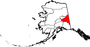 | |
| CDPs | ||
| Unincorporated communities | ||