Kozhikode East
| Kozhikode East | |
|---|---|
| town | |
|
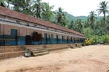
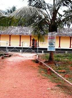
Peruvayal school | |
| Coordinates: 11°18′23″N 75°52′44″E / 11.30639°N 75.87889°ECoordinates: 11°18′23″N 75°52′44″E / 11.30639°N 75.87889°E | |
| Country |
|
| State | Kerala |
| Region | South India |
| District | Kozhikode |
| Population | |
| • Total | 47,396 |
| Languages | |
| • Official | Malayalam |
| Time zone | IST (UTC+5:30) |
| PIN | 673571 |
| Nearest city | Kozhikode |
| Lok Sabha constituency | Kozhikode |
| Vidhan Sabha constituency | Kunnamangalam |


Kozhikode East is an suburb of Kozhikode city in India. Kozhikode East includes areas outside the city jurisdiction but they are still closely associated with the city in terms of commerce and everyday life.
Location
Kozhikode East mainly includes area covered by the Wayanad Road from Vellimadukunnu to Kunnamangalam. The term Mavoor Road is used only for the stretch of the road from Mananchira to Calicut Medical College. The remaining part of the road up to Mavoor village is also considered as Kozhikode East. These two roads are connected by the Mayanad Road which forms a third constituent of Kozhikode East.
Suburbs and Townships
- Koduvally, Chathamangalam, Kettangal and Kunnamangalam,Mukkam
- Vellimadukunnu, Paroppady and Cheruvatta
- Mayanad, Moozhikkal and Mavoor.
- Arambram, Chennamangallur and Eranchiparamb,Koolimadu
- Karassery, Kattangal and Koduvally
- Kumaranallur , Manashery, Moozhikkal,Kodiyathur
- Palangad, Pazhur ,Cheruvadi and Peringolam
- Perumanna, Peruvayal and Poolacode
- Pottassery and Thazhecode
The Kovoor Walk
On both sides of the national highway in Kovoor Town you can find green paddy fields filled with coconut gardens on the fringes. There is a footpath from Kovoor Town to Iringadan Pally village which takes your further to the Vellimadukunnu Hills on the Wayanad Road. This walk can be extended up to the Poolakkadavu river and the little foot bridge leading to Parambil Bazar town.
Chevayur Township
Chevayur is a suburban town of Kozhikode city in India. It is at a distance of 2 km from Calicut Medical College and 5 km from Kozhikode city. Chevayur is near other important residential locations like Chevarambalam, Kovoor Town and Thondayad Junction. On the southern side, Chevayur is connected by SBI Colony Road and Gas Godown Road to Palazhi and Nellikkunnu areas. On the northern side, Chevarambalam road and Iringadan pally Road connects Chevayur with Vellimadukunnu area on the Wayanad road.
Important Organizations
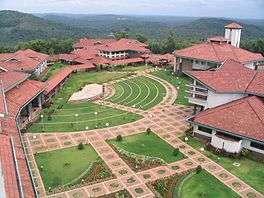
- Indian Institute of Management, Kunnamangalam.
- National Institute of Technology, Chathamangalam.
- KMCT Engineering College
- KMCT Medical College
- National Institute of Electronics and Information Technology
- The Centre for Water Resources Development and Management
- Markaz, Karanthur
- Indian Institute of Spices Research
- Kozhikode Medical College
Other Landmarks
- Hara Hara Mahadheva Temple, Karanthur
- SNES Institute of Management Studies, Chethukadavu
- Kerala School of Mathematics
- Dayapuram Educational and Cultural Centre
- Auxilium Navajyoti Higher Secondary School
- MES Raja Residential School
- Indian Theosophical society
- Water Resource Museum, Peringalam.
- St. Joseph Devagiri College.
Mavoor Road after Medical College
The term Mavoor Road is used only for the 8.3 km stretch of road between Mananchira and Calicut Medical College. The road goes another 13 kam and ends in Mavoor town. This second stretch of Mavoor town has many important towns and villages like:
Location
 |
Malaparamba | Silver Hills | Kunnamangalam | |
| Chevarambalam Junction | |
Mavoor | ||
| ||||
| | ||||
| Chevayur | Palazhi |
See also
Image gallery
-
Kunnamangalam Panchayath
-

View from inside the medical college
-
Coffee House at Medical College
-
Maternity Hospital at Chevayoor
-

NIT Office
-

NIT Calicut
-
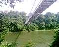
Chaliyar River
-

Super Speciality Hospital
-

N.I.T.Stadium
-
Brochure of CWRDM