Chapleau 74A
| Chapleau 74A | |
|---|---|
| Indian reserve | |
| Chapleau Indian Reserve No. 74A | |
 Chapleau 74A | |
| Coordinates: 47°48′N 83°23′W / 47.800°N 83.383°WCoordinates: 47°48′N 83°23′W / 47.800°N 83.383°W | |
| Country |
|
| Province |
|
| District | Sudbury |
| First Nation | Chapleau Ojibway |
| Area[1] | |
| • Land | 7.63 km2 (2.95 sq mi) |
| Population (2011)[1] | |
| • Total | 31 |
| • Density | 4.1/km2 (11/sq mi) |
| Website | chapleauojibwe.ca |
Chapleau 74A is a First Nations reserve located near Chapleau, Ontario. It is one of several reserves of the Chapleau Ojibway First Nation.
References
- 1 2 "Chapleau 74A census profile". 2011 Census of Population. Statistics Canada. Retrieved 2015-05-21.
 |
Unorganized North Sudbury | | ||
| Chapleau | |
Unorganized North Sudbury | ||
| ||||
| | ||||
| Unorganized North Sudbury |
| Towns | 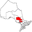 | |
|---|---|---|
| Townships | ||
| First Nations | ||
| Indian reserves | ||
| Unorganized area | ||
| Local services boards | ||
| ||
This article is issued from Wikipedia - version of the 1/26/2016. The text is available under the Creative Commons Attribution/Share Alike but additional terms may apply for the media files.