Chã de Tanque
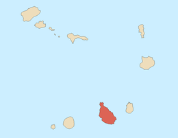
Chã de Tanque or Chão de Tanque is a village in the westcentral part of the island of Santiago, Cape Verde. Its 2010 population was 1,164. It is situated 4 km west of Assomada, it is also south of Ribeirão Manuel and northwest of Palha Carga. The elevation is about 285 meters above sea level. It is nearly in the middle of the road linking Assomada and Porto Rincão. The built up area stretches for a kilometer along the main road.
The villages sits above Ribeira de Mato Sancho where it meets the Ribeirão Manuel and the remainder flows to the Atlantic as Ribeira das Águas Belas.
Agriculture dominates the area, once dominated by grasslands, it is mainly dominated by groves today.
A variant of tabanka is the Chã de Tanque variant used in music, it is common up to the areas surrounding the village.[2]
Until 2008, it was the furthermost paved portion of the Assomada-Porto Rincão Road, today it is completely paved.
In 2011, a new museum opened not far from the village at Casa da Morgado, restored in 2009, a rural farmhouse built in the 19th century.
References
|
|---|
|
| Communities and settlements | | |
|---|
|
| Geographical features | |
|---|
|
| Landmarks and points of Interests | |
|---|
|
| Culture | |
|---|
|
|