Cemitério de São João Batista
|
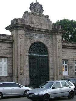
Main entrance of the cemetery | |
| Details | |
|---|---|
| Established | 1852 |
| Location | Rio de Janeiro |
| Country | Brazil |
| Coordinates | 22°57′32″S 43°11′17″W / 22.959°S 43.188°W |
| Type | Public |
Cemitério de São João Batista (Saint John the Baptist's Cemetery) is a municipal necropolis originally owned and operated by the Santa Casa da Misericórdia do Rio de Janeiro (Holy House of Mercy of Rio de Janeiro), and run, since August 2014, by the private company Rio Pax.[1]
Located in the neighborhood of Botafogo, it is the only cemetery in the city's south area, and, on October 5, 2015, it became the first cemetery in Latin America to be featured in Google Street View.[2]
Notable burials

Partial view of the cemetery with the Christ the Redeemer statue in the background

Grave of Tom Jobim
.jpg)
Grave of Carmen Miranda
- Álvares de Azevedo – Brazilian poet, playwright and essayist
- Alberto Santos-Dumont – Brazilian aviator
- Antonio Carlos Jobim – Brazilian musician (composer of "The Girl From Ipanema")
- Artur Bernardes – 12th President of Brazil
- Artur da Costa e Silva – 27th President of Brazil
- Aurora Miranda – Brazilian singer, dancer, sister of Carmen Miranda
- Bussunda – Brazilian comedian and TV personality.
- Café Filho - 18th President of Brazil
- Cândido Portinari – Brazilian painter
- Cândido Rondon – Brazilian explorer
- Carmélia Alves – Brazilian singer
- Carmen Miranda – Portuguese Brazilian singer and actress
- Cazuza – Brazilian composer and singer
- Cecília Meireles – Brazilian writer and educator
- Chacrinha – Brazilian TV entertainer
- Clara Nunes – Brazilian singer
- Dorival Caymmi – Brazilian musician, actor, and painter
- Emílio Garrastazu Médici – 28th Brazilian President
- Ernesto Geisel – 29th President of Brazil
- Eurico Gaspar Dutra – 16th President of Brazil
- Floriano Peixoto – 2nd President of Brazil
- Heitor Villa-Lobos – Brazilian composer
- João Alfredo Correia de Oliveira - Prime Minister of the Brazilian Empire
- João Figueiredo - 30th Presidente of Brazil
- João Havelange - 7th President of FIFA
- José Linhares – 15th President of Brazil
- Júlio Ximenes Sênior – Brazilian scientist, author and Brazilian Army General
- Luís Cruls – Belgian-born Brazilian astronomer and geodesist[3]
- Marcelo Caetano – Prime-Minister of Portugal
- Marília Pêra – Brazilian actress
- Nelson Gonçalves – Brazilian singer
- Nelson Rodrigues – Brazilian playwright, journalist and novelist
- Nilo Peçanha – 7th President of Brazil
- Oscar Cox – Founder of Fluminense Football Club
- Osvaldo Aranha – Brazilian diplomat
- Oswaldo Cruz - Brazilian physician, bacteriologist, epidemiologist and public health officer and the founder of the Oswaldo Cruz Institute
- Roberto Marinho – Founder of the biggest Brazilian TV channel, Rede Globo
- Vinicius de Moraes – Brazilian poet, composer and diplomat
References
- ↑ Christina Nascimento (August 13, 2014). "Monopólio centenário no fim" (in Portuguese). Retrieved October 20, 2015.
- ↑ "Cemitério São João Batista no RJ agora pode ser visto no Google Street View" (in Portuguese). October 7, 2015. Retrieved October 20, 2015.
- ↑ Maarten Lambrechts. "Louis Cruls: Het leven van een Belgo-Braziliaanse astronoom, ingenieur en avonturier".
Coordinates: 22°57′32″S 43°11′17″W / 22.959°S 43.188°W
This article is issued from Wikipedia - version of the 12/1/2016. The text is available under the Creative Commons Attribution/Share Alike but additional terms may apply for the media files.