Caryville, Florida
| Caryville, Florida | |
|---|---|
| Town | |
 Location in Washington County and the state of Florida | |
| Coordinates: 30°46′32″N 85°48′38″W / 30.77556°N 85.81056°WCoordinates: 30°46′32″N 85°48′38″W / 30.77556°N 85.81056°W | |
| Country |
|
| State |
|
| County | Washington |
| Area | |
| • Total | 3.1 sq mi (8.1 km2) |
| • Land | 3 sq mi (7.8 km2) |
| • Water | 0.1 sq mi (0.3 km2) |
| Elevation | 52 ft (16 m) |
| Population (2000) | |
| • Total | 218 |
| • Density | 70.3/sq mi (26.9/km2) |
| Time zone | Central (CST) (UTC-6) |
| • Summer (DST) | CDT (UTC-5) |
| ZIP code | 32427 |
| Area code(s) | 850 |
| FIPS code | 12-10975[1] |
| GNIS feature ID | 0294706[2] |
Caryville is a town in Washington County, Florida, United States. The population was 218 at the 2000 census.
Geography
Caryville is located at 30°46′32″N 85°48′38″W / 30.77556°N 85.81056°W (30.775620, -85.810506).[3]
According to the United States Census Bureau, the town has a total area of 3.2 square miles (8.3 km2), of which 3.0 square miles (7.8 km2) is land and 0.1 square miles (0.26 km2) (4.13%) is water.
Demographics
| Historical population | |||
|---|---|---|---|
| Census | Pop. | %± | |
| 1920 | 440 | — | |
| 1930 | 1,022 | 132.3% | |
| 1940 | 279 | −72.7% | |
| 1950 | 525 | 88.2% | |
| 1960 | 730 | 39.0% | |
| 1970 | 724 | −0.8% | |
| 1980 | 633 | −12.6% | |
| 1990 | 631 | −0.3% | |
| 2000 | 218 | −65.5% | |
| 2010 | 411 | 88.5% | |
| Est. 2015 | 280 | [4] | −31.9% |
As of the census[1] of 2000, there were 218 people, 86 households, and 57 families residing in the town. The population density was 72.1 inhabitants per square mile (27.9/km²). There were 110 housing units at an average density of 36.4 per square mile (14.1/km²). The racial makeup of the town was 73.39% White, 20.64% African American, 1.38% Native American, 2.75% from other races, and 1.83% from two or more races. Hispanic or Latino of any race were 5.96% of the population.
There were 86 households out of which 36.0% had children under the age of 18 living with them, 48.8% were married couples living together, 15.1% had a female householder with no husband present, and 32.6% were non-families. 26.7% of all households were made up of individuals and 12.8% had someone living alone who was 65 years of age or older. The average household size was 2.53 and the average family size was 3.16.
In the town the population was spread out with 32.1% under the age of 18, 6.4% from 18 to 24, 28.9% from 25 to 44, 19.3% from 45 to 64, and 13.3% who were 65 years of age or older. The median age was 32 years. For every 100 females there were 115.8 males. For every 100 females age 18 and over, there were 97.3 males.
The median income for a household in the town was $22,500, and the median income for a family was $28,750. Males had a median income of $25,000 versus $15,625 for females. The per capita income for the town was $11,385. About 16.7% of families and 37.3% of the population were below the poverty line, including 66.7% of those under the age of eighteen and 35.1% of those sixty five or over.
Notable people
- Robert L. Carter, United States District Court judge and civil rights activist
- Bob Thorpe, Major League Baseball player
References
- 1 2 "American FactFinder". United States Census Bureau. Archived from the original on 2013-09-11. Retrieved 2008-01-31.
- ↑ "US Board on Geographic Names". United States Geological Survey. 2007-10-25. Retrieved 2008-01-31.
- ↑ "US Gazetteer files: 2010, 2000, and 1990". United States Census Bureau. 2011-02-12. Retrieved 2011-04-23.
- ↑ "Annual Estimates of the Resident Population for Incorporated Places: April 1, 2010 to July 1, 2015". Retrieved July 2, 2016.
- ↑ "Census of Population and Housing". Census.gov. Archived from the original on April 22, 2013. Retrieved June 4, 2015.
Municipalities and communities of Washington County, Florida, United States | ||
|---|---|---|
| Cities | 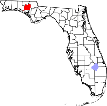 | |
| Towns | ||
| Unincorporated community | ||