Caneadea Bridge
| Caneadea Bridge | |
|---|---|
 Caneadea Bridge, September 2012 | |
| Carries | County Road 46 |
| Crosses | Genesee River |
| Locale | Caneadea, New York |
| Characteristics | |
| Design | Camel Parker Truss |
| Total length | 246 feet (75 m) |
| Width | 14 feet (4.3 m) |
| Clearance above | about 15 feet (4.6 m) |
| History | |
| Designer | Groton Iron Bridge Co. |
|
Caneadea Bridge | |
  | |
| Coordinates | 42°23′6″N 78°8′59″W / 42.38500°N 78.14972°WCoordinates: 42°23′6″N 78°8′59″W / 42.38500°N 78.14972°W |
| Area | 1 acre (0.40 ha) |
| NRHP Reference # | 98001388[1] |
| Added to NRHP | November 19, 1998 |
Caneadea Bridge, also known as East Hill Road Bridge,[2] is a historic steel truss bridge that carries County Road 46 (locally East Hill Road) over the Genesee River in Caneadea, Allegany County, New York. It is listed on the National Register of Historic Places.
History
In 1902, a catastrophic flood washed away the previous bridge.[3] Shortly after, the town of Caneadea hired the Groton Iron Bridge Company for a replacement span; the new bridge was completed in November 1903.[3][4]
The bridge was nominated for inclusion on the National Register of Historic Places under Criterion C for its engineering significance as a surviving early twentieth-century bridge.[3] In a NYSDOT survey, it was the oldest and longest of two surviving camelback truss bridges in New York.[5] The bridge was listed on the National Register on November 19, 1998.[6]
In 1993, the Allegany County Department of Public Works declared the bridge unsafe and it was closed because the county could not afford to replace it. The closure was an inconvenience, forcing some drivers to go south and cross the river at Belfast before heading back to Caneadea. The Save the Caneadea Bridge Committee worked for the next fourteen years to raise funds for rehabilitation; an undisclosed sum was raised, plus about $550,000 in state funding. The bridge reopened in 2007, and the remaining $9,037.42 was assigned for maintenance.[4]
The bridge was closed again on June 26, 2012, because of structural deterioration.[7] In August 2012, an engineering firm was hired to study what would need to be done to reopen the bridge to traffic.[8]
Design
The bridge consists of a single-span steel truss, measuring 246 by 14 feet (75.0 by 4.3 m), resting on cut stone abutments. It is a pin-connected, camelback Parker truss design, set about 15 feet (4.6 m) above the river. The ends of the bridge retain the original metal cresting and decorative plates bearing the bridge company name and former town names.[9]
See also
- National Register of Historic Places listings in Allegany County, New York
- List of bridges and tunnels on the National Register of Historic Places in New York
References
- ↑ National Park Service (2009-03-13). "National Register Information System". National Register of Historic Places. National Park Service.
- ↑ Petrick 1998, p. 1.
- 1 2 3 Petrick 1998, p. 5.
- 1 2 Quinn, Brian (March 1, 2009). "Allegany County gets nest egg for Caneadea bridge maintenance". Wellsville Daily Reporter. Archived from the original on December 1, 2013. Retrieved December 1, 2013.
- ↑ Petrick 1998, p. 6.
- ↑ "Weekly List of Actions Taken on Properties: 11/16/98 Through 11/20/98". National Register of Historic Places. National Park Service. Retrieved December 1, 2013.
- ↑ Staff (June 26, 2012). "Caneadea bridge on county Road 46 closed indefinitely". Wellsville Daily Reporter. Archived from the original on December 1, 2013. Retrieved December 1, 2013.
- ↑ Quinn, Brian (August 28, 2012). "Engineer to study bridge needs". Wellsville Daily Reporter. Archived from the original on December 1, 2013. Retrieved December 1, 2013.
- ↑ Petrick 1998, p. 4.
Bibliography
- Petrick, Michelle (November 19, 1998). "National Register of Historic Places Registration: Caneadea Bridge". New York State Office of Parks, Recreation and Historic Preservation. Retrieved December 1, 2013. See also: "Accompanying three photos".
External links
![]() Media related to Caneadea Bridge at Wikimedia Commons
Media related to Caneadea Bridge at Wikimedia Commons
| Topics |  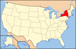 | |
|---|---|---|
| Lists by county |
| |
| Lists by city | ||
| Other lists | ||
| ||