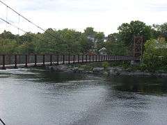
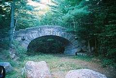
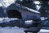
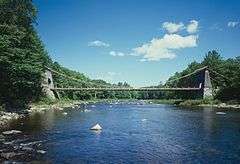
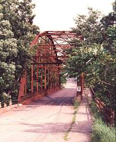
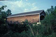
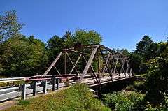
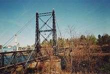
List of bridges on the National Register of Historic Places in Maine

This is a list of bridges and tunnels on the National Register of Historic Places in the U.S. state of Maine.[1]

Name Image Built Listed Location County Type
Androscoggin Swinging Bridge 1892, by 1913, 1936 2004-01-14 Brunswick
43°55′6″N 69°58′26″W / 43.91833°N 69.97389°W / 43.91833; -69.97389 (Androscoggin Swinging Bridge)
Cumberland Suspension Bridge
Arch Bridge ca. 1857 2003-07-07 Bristol
43°57′44″N 69°30′35″W / 43.96222°N 69.50972°W / 43.96222; -69.50972 (Arch Bridge)
Lincoln Stone arch bridge
Babb's Bridge 1976 replica of 1864 bridge 1972-09-07 Windham
43°45′58″N 70°26′53″W / 43.76611°N 70.44806°W / 43.76611; -70.44806 (Babb's Bridge)
Cumberland 1864 bridge destroyed by arson in 1973.
Bailey Island Cobwork Bridge 1928 1975-04-28 Harpswell
43°44′55″N 69°59′22″W / 43.74861°N 69.98944°W / 43.74861; -69.98944 (Bailey Island Cobwork Bridge)
Cumberland The only surviving cribstone bridge in the world
Bennett Bridge 1901 1970-02-16 Wilson Mills
44°55′4″N 71°2′21″W / 44.91778°N 71.03917°W / 44.91778; -71.03917 (Bennett Bridge)
Oxford Paddleford truss
Carriage Paths, Bridges and Gatehouses 1919, 1931 1979-11-14 Acadia National Park Hancock Gothic Arched Bridges
Churchill Bridge 1797 1994-03-17 Buckfield
44°14′44″N 70°23′10″W / 44.24556°N 70.38611°W / 44.24556; -70.38611 (Churchill Bridge)
Oxford Stone lintel bridge
Grist Mill Bridge ca. 1885 1990-12-27 Lebanon
43°23′30″N 70°51′6″W / 43.39167°N 70.85167°W / 43.39167; -70.85167 (Grist Mill Bridge)
York A non-trussed, timber bridge on stone abutments improved in 1950 and restored in 1993.
Hemlock Bridge 1857 1970-02-16 Fryeburg Center
44°4′46″N 70°54′13″W / 44.07944°N 70.90361°W / 44.07944; -70.90361 (Hemlock Bridge)
Oxford Paddleford Truss
Lovejoy Bridge 1868 1970-02-16 South Andover
44°35′37″N 70°44′2″W / 44.59361°N 70.73389°W / 44.59361; -70.73389 (Lovejoy Bridge)
Oxford Paddleford truss
Morse Bridge 1882 1970-02-16
delisted 2015-09-29
Bangor
44°48′28″N 68°46′43″W / 44.80778°N 68.77861°W / 44.80778; -68.77861 (Morse Bridge)
Penobscot Covered bridge; burned down in the 1980s.
New Portland Wire Bridge 1864-1866 1970-01-12 New Portland
44°53′27″N 70°5′37″W / 44.89083°N 70.09361°W / 44.89083; -70.09361 (New Portland Wire Bridge)
Somerset Possibly the only surviving wire (suspension) bridge in the United States. It has covered, timber framed towers.
New Sharon Bridge 1916 1999-09-24
delisted 2015-07-14
New Sharon
44°38′16″N 70°0′56″W / 44.63778°N 70.01556°W / 44.63778; -70.01556 (New Sharon Bridge)
Franklin Pennsylvania Thru Truss; this bridge was torn down in 2014.
Porter-Parsonfield Bridge 1876 1970-02-16 Porter
43°47′30″N 70°56′18″W / 43.79167°N 70.93833°W / 43.79167; -70.93833 (Porter-Parsonfield Bridge)
Oxford, York Paddleford Truss
Robyville Bridge 1876 1970-02-16 Robyville
44°56′35″N 68°58′8″W / 44.94306°N 68.96889°W / 44.94306; -68.96889 (Robyville Bridge)
Penobscot Howe Truss System
Ryefield Bridge 1912 1999-09-24 Stuarts Corner
44°8′34″N 70°35′43″W / 44.14278°N 70.59528°W / 44.14278; -70.59528 (Ryefield Bridge)
Cumberland and Oxford Warren through truss
Smith Bridge 1910 1993-04-02
removed 2013-12-08
Houlton
46°10′52″N 67°48′16″W / 46.18111°N 67.80444°W / 46.18111; -67.80444 (Smith Bridge)
Aroostook 2-Span Warren Pony Truss
Sunday River Bridge 1872 1970-02-16 Newry
44°29′31″N 70°50′36″W / 44.49194°N 70.84333°W / 44.49194; -70.84333 (Sunday River Bridge)
Oxford Paddleford Truss
Thompson's Bridge ca. 1808 1991-03-22 Allen's Mills
44°43′36″N 70°0′25″W / 44.72667°N 70.00694°W / 44.72667; -70.00694 (Thompson's Bridge)
Franklin Stone lintel
Two Cent Bridge 1903 1973-09-20 Waterville-Winslow
44°33′3″N 69°37′45″W / 44.55083°N 69.62917°W / 44.55083; -69.62917 (Two Cent Bridge)
Kennebec Suspension type
Watson Settlement Bridge 1911 1970-02-16 Littleton
46°12′36″N 67°48′3″W / 46.21000°N 67.80083°W / 46.21000; -67.80083 (Watson Settlement Bridge)
Aroostook Howe Truss System
Lowe's Bridge 1857
removed 1987-05-12
Sangerville Piscataquis Long Truss system
Waldo-Hancock Bridge 1931 Listed 1985-06-20
Delisted 2013-12-08
Prospect, Verona
44°33′37″N 68°48′8″W / 44.56028°N 68.80222°W / 44.56028; -68.80222 (Waldo-Hancock Bridge)
Hancock, Waldo Suspension bridge; demolished in 2013

References

  1. National Park Service (2010-07-09). "National Register Information System". National Register of Historic Places. National Park Service.
This article is issued from Wikipedia - version of the 2/11/2016. The text is available under the Creative Commons Attribution/Share Alike but additional terms may apply for the media files.