Caloundra (suburb)
This article is about the suburb. For the larger urban area, see Caloundra.
| Caloundra Sunshine Coast, Queensland | |||||||||||||
|---|---|---|---|---|---|---|---|---|---|---|---|---|---|
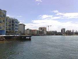 Caloundra waterfront, 2008 | |||||||||||||
| Coordinates | 26°47′56″S 153°07′59″E / 26.799°S 153.133°ECoordinates: 26°47′56″S 153°07′59″E / 26.799°S 153.133°E | ||||||||||||
| Population | 3,558 (2011 census)[1] | ||||||||||||
| • Density | 912/km2 (2,363/sq mi) | ||||||||||||
| Postcode(s) | 4551 | ||||||||||||
| Area | 3.9 km2 (1.5 sq mi) | ||||||||||||
| Location |
| ||||||||||||
| LGA(s) | Sunshine Coast Region | ||||||||||||
| County | Canning | ||||||||||||
| Parish | Bribie | ||||||||||||
| State electorate(s) | Caloundra | ||||||||||||
| Federal Division(s) | Fisher | ||||||||||||
| |||||||||||||
Caloundra is a suburb of the Sunshine Coast, Queensland, Australia, and includes the central business district of the Caloundra urban centre, which is located on Bulcock Street. At the 2011 Australian Census the suburb recorded a population of 3,558.[1]
Heritage listings
The suburb of Caloundra has a number of heritage-listed sites, including:
- Bowman Road: Tripcony Hibiscus Caravan Park[2]
Education
Caloundra contains the following schools within its boundaries:
- Caloundra State School (1889)
- Caloundra State High School (1967)
- Caloundra Christian College (1983)
Caloundra is also home to a campus of the Sunshine Coast Institute of TAFE.
Shopping
- Stockland Caloundra
- Caloundra Village Shopping Centre
Parks and recreation
- Bulcock Beach (patrolled by Ithaca–Caloundra City Life Saving Club) and Clarke Place Park
- Central Park (includes Caloundra Tennis Centre, which hosts the Caloundra International)
- Ben Bennett Botanical Park
- Bicentennial Park
- Lighthouse Park
- Roy Henzell Park
Other facilities
- Caloundra Hospital[3]
- Caloundra bus station
- Caloundra Golf Club
- Council service centre for Sunshine Coast Region
- A range of accommodation from backpackers to resort hotels
References
- 1 2 Australian Bureau of Statistics (31 October 2012). "Caloundra (State Suburb)". 2011 Census QuickStats. Retrieved 29 September 2014.
- ↑ "Tripcony Hibiscus Caravan Park (entry 602708)". Queensland Heritage Register. Queensland Heritage Council. Retrieved 14 July 2013.
- ↑ Department of Health (Queensland). "Sunshine Coast Health Service District - Caloundra Health Service". Retrieved 21 June 2011.
External links
 Media related to Category:Caloundra, Queensland at Wikimedia Commons
 Caloundra travel guide from Wikivoyage
This article is issued from Wikipedia - version of the 11/15/2016. The text is available under the Creative Commons Attribution/Share Alike but additional terms may apply for the media files.