Woombye, Queensland
| Woombye Sunshine Coast, Queensland | |||||||||||||
|---|---|---|---|---|---|---|---|---|---|---|---|---|---|
 | |||||||||||||
| Population | 2,094 (2006 census)[1] | ||||||||||||
| Postcode(s) | 4559 | ||||||||||||
| Location | 98 km (61 mi) N of Brisbane | ||||||||||||
| LGA(s) | Sunshine Coast Region | ||||||||||||
| State electorate(s) | |||||||||||||
| Federal Division(s) | Fairfax | ||||||||||||
| |||||||||||||
Woombye is a town located on the Sunshine Coast hinterland in Queensland, Australia, approximately 100 kilometres (62 mi) north of the Brisbane CBD. The name is derived from words from the local Aboriginal language - a place (wumbai) of black snake, or (wambai) black myrtle or axe handle made from black myrtle.[2] Woombye has a population of 2,094, as measured in the 2006 census.
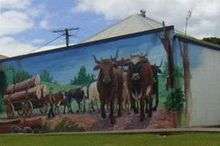
The small township of Woombye is surrounded by what were once pineapple farms, which today are acreage properties and gated communities. Woombye is home to one of the longest established soccer clubs on the Sunshine Coast, the Woombye Snakes. Woombye is also the location of an Australian tourist icon The Big Pineapple.
Woombye is accessible by Translink trains and buses. The town is centered on its railway station on the North Coast railway line[3] with numerous rail services departing for Brisbane daily.
History
Following the discovery of gold at Gympie in 1867, the Government built a road connecting Brisbane to Gympie. It was completed in October 1868 and by November, Cobb & Co coaches were carrying passengers, mail, goods and gold between Brisbane and Gympie. Ten staging depots were established along the route, where horses and fodder were kept. One of these depots was 'Middle Camp', half way between Brisbane and Gympie. Here Cobb & Co built the only accommodation for passengers along its route, and the inn and its surrounding buildings soon became known as Cobb's Camp Hotel.
In 1877, Karl Stumpf was granted a licence to sell liquor there. In 1880 the Brisbane to Gympie Road had become almost untrafficable and the alluvial gold in Gympie was almost played out, so Cobb & Co withdrew their coach services.
In 1881, Frederick Schubert took charge of the hotel, and purchased 160 acres (0.65 km2) of land, which included all Cobb & Co's land and buildings and is the area on which the township of Woombye now stands. He built a store and a butcher's shop.
In the 1880s, the Court House was built near the police station. The existing name "Cobb's Camp" was considered unsuitable by the Government as there were already many places of that name. So the name Woombye was chosen, after the myrtle tree which grew locally.
The town was surveyed in 1890 and in 1891 the railway from Landsborough to Yandina was opened. From 1891 to 1914, Woombye became the rail centre to which Buderim farmers carted all their fruit and produce to rail to the markets, until the Buderim tramway connected Buderim and Palmwoods.
In 1894, Woombye State School was erected to replace the provisional school.
In 1895, Thomas Bartholomew built a sawmill near the railway yards and it operated until 1965. Equally important, in 1895, Thomas Davey grew the first pineapples commercially in Woombye. Other growers quickly followed him and by 1903, there were 120 acres (0.49 km2) of pineapples in the district.
In 1897, Thomas McClintock set up a blacksmith's shop in the police stables after the staff had been transferred to Nambour. In 1898, the Church of England church and the first Woombye School of Arts building were erected. Also John Tytherleigh established a branch store in Woombye, which operated until 1965.
In 1900, the Methodist church was built, Louis Willersdorf built the first bakery in Woombye. Frederick Schubert built the Criterion Hotel on the corner above the railway yards where it still stands, and the Maroochy Pastoral, Agricultural, Horticultural and Industrial Society was formed and the first Show was held in Woombye on 3 June 1900.[4]

The Woombye War Memorial was unveiled on 18 June 1925 by the Queensland Governor, Matthew Nathan.[5][6]
Heritage listings
Woombye has a number of heritage-listed sites, including:
- Nambour Connection Road: North Coast Roadside Rest Areas[7]
- Nambour Connection Road: The Big Pineapple (former Sunshine Plantation)[8]
References
- ↑ Australian Bureau of Statistics (25 October 2007). "Woombye (State Suburb)". 2006 Census QuickStats. Retrieved 16 March 2008.
- ↑ "Place Name Origins - Maroochy Shire Council". Maroochy Shire. 2006.
- ↑ Woombye on the North Coast Line. Milne, Rod. Australian Railway Historical Society Bulletin. December 1997. pp435-441.
- ↑ "History of Early Settlement - Sunshine Coast Regional Council". Sunshine Coast Regional Council. 2007.
- ↑ "Woombye War Memorial". Monument Australia. Retrieved 3 April 2014.
- ↑ "Dedication Service.". Nambour Chronicle and North Coast Advertiser (Qld. : 1922 - 1954). Qld.: National Library of Australia. 10 July 1925. p. 8. Retrieved 4 April 2014.
- ↑ "North Coast Roadside Rest Areas (entry 602698)". Queensland Heritage Register. Queensland Heritage Council. Retrieved 14 July 2013.
- ↑ "The Big Pineapple (former Sunshine Plantation) (entry 602694)". Queensland Heritage Register. Queensland Heritage Council. Retrieved 14 July 2013.
External links
| Wikimedia Commons has media related to Woombye, Queensland. |
Coordinates: 26°40′S 152°58′E / 26.667°S 152.967°E