California State Route 253
| ||||
|---|---|---|---|---|
|
Map of Mendocino County in northwestern California with SR 253 highlighted in red | ||||
| Route information | ||||
| Defined by Streets and Highways Code § 553 | ||||
| Maintained by Caltrans | ||||
| Length: | 17.180 mi[1] (27.649 km) | |||
| Major junctions | ||||
| West end: |
| |||
| East end: |
| |||
| Location | ||||
| Counties: | Mendocino | |||
| Highway system | ||||
| ||||

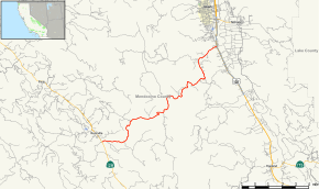
State Route 253, also known as the Ukiah–Boonville Road, is a highway in Mendocino County, California. It runs from California State Route 128 near Boonville to U.S. Route 101 near Ukiah, connecting the Anderson Valley to the Ukiah Valley across the mountains of the Mendocino Range.
Route description
The road begins in Boonville at an at-grade intersection with SR 128. The road heads eastward through a forested and mountainous area for approximately fifteen miles before entering the Russian River Basin, where numerous farms exist. The road ends with an interchange with U.S. Route 101 in southern Ukiah.[2]
History
This route, under the name of the Ukiah-Boonville Road, has been in use as a road since at least 1897, when it was the scene of the robbery of a stage coach carrying the payrolls for a coastal lumber mill.[3] However, it was not a state highway until 1963, when it was added to the state highway system. It was given its present number in the 1964 state highway renumbering.
Major intersections
Except where prefixed with a letter, postmiles were measured on the road as it was in 1964, based on the alignment that existed at the time, and do not necessarily reflect current mileage. R reflects a realignment in the route since then, M indicates a second realignment, L refers an overlap due to a correction or change, and T indicates postmiles classified as temporary (for a full list of prefixes, see the list of postmile definitions).[1] Segments that remain unconstructed or have been relinquished to local control may be omitted. The entire route is in Mendocino County.
| Location | Postmile [1][4][5] | Destinations | Notes | ||
|---|---|---|---|---|---|
| Boonville | 0.00 | West end of SR 253 | |||
| Ukiah | 17.18 | Interchange; east end of SR 253 | |||
| 17.18 | State Street – Ukiah | Continuation beyond US 101 | |||
| 1.000 mi = 1.609 km; 1.000 km = 0.621 mi | |||||
References
- 1 2 3 California Department of Transportation. "State Truck Route List". Sacramento: California Department of Transportation. Archived from the original (XLS file) on June 30, 2015. Retrieved June 30, 2015.
- ↑ Microsoft; Nokia (2011-01-12). "California State Route 253" (Map). Bing Maps. Microsoft. Retrieved 2011-01-12.
- ↑ Palmer, Lyman L. (1967), History of Mendocino County, California, comprising its geography, geology, topography, climatography, springs and timber, Mendocino County Historical Society, p. 738.
- ↑ California Department of Transportation, Log of Bridges on State Highways, July 2007
- ↑ California Department of Transportation, All Traffic Volumes on CSHS Archived July 21, 2011, at the Wayback Machine., 2006
External links
- Caltrans: Route 253 highway conditions
- California Highways: Route 253
- View South from Route 253 at Boonville