Caledonia, Ohio
| Caledonia, Ohio | |
|---|---|
| Village | |
|
Town hall on the public square | |
 Location of Caledonia, Ohio | |
 Location of Caledonia in Marion County | |
| Coordinates: 40°38′10″N 82°58′9″W / 40.63611°N 82.96917°WCoordinates: 40°38′10″N 82°58′9″W / 40.63611°N 82.96917°W | |
| Country | United States |
| State | Ohio |
| County | Marion |
| Area[1] | |
| • Total | 0.23 sq mi (0.60 km2) |
| • Land | 0.23 sq mi (0.60 km2) |
| • Water | 0 sq mi (0 km2) |
| Elevation[2] | 994 ft (303 m) |
| Population (2010)[3] | |
| • Total | 577 |
| • Estimate (2012[4]) | 565 |
| • Density | 2,508.7/sq mi (968.6/km2) |
| Time zone | Eastern (EST) (UTC-5) |
| • Summer (DST) | EDT (UTC-4) |
| ZIP code | 43314 |
| Area code(s) | 419 |
| FIPS code | 39-10954[5] |
| GNIS feature ID | 1056754[2] |
| Website | http://www.caledonia-village.com |

Caledonia is a village in Marion County, Ohio, United States. The population was 577 at the 2010 census.
History
The village was named after Caledonia, an ancient name for Scotland, the ancestral home of a large share of the first settlers.[6]
The northern side of Caledonia is the location of the Caledonia Bowstring Bridge, which is listed on the National Register of Historic Places.[7]
Geography
Caledonia is located at 40°38′10″N 82°58′9″W / 40.63611°N 82.96917°W (40.636068, -82.969301).[8]
According to the United States Census Bureau, the village has a total area of 0.23 square miles (0.60 km2), all land.[1]
Demographics
| Historical population | |||
|---|---|---|---|
| Census | Pop. | %± | |
| 1870 | 419 | — | |
| 1880 | 627 | 49.6% | |
| 1890 | 757 | 20.7% | |
| 1900 | 682 | −9.9% | |
| 1910 | 562 | −17.6% | |
| 1920 | 492 | −12.5% | |
| 1930 | 526 | 6.9% | |
| 1940 | 629 | 19.6% | |
| 1950 | 655 | 4.1% | |
| 1960 | 673 | 2.7% | |
| 1970 | 792 | 17.7% | |
| 1980 | 759 | −4.2% | |
| 1990 | 644 | −15.2% | |
| 2000 | 578 | −10.2% | |
| 2010 | 577 | −0.2% | |
| Est. 2015 | 557 | [9] | −3.5% |
2010 census
As of the census[3] of 2010, there were 577 people, 232 households, and 174 families residing in the village. The population density was 2,508.7 inhabitants per square mile (968.6/km2). There were 260 housing units at an average density of 1,130.4 per square mile (436.4/km2). The racial makeup of the village was 97.4% White, 1.6% African American, 0.2% Asian, 0.7% from other races, and 0.2% from two or more races. Hispanic or Latino of any race were 0.5% of the population.
There were 232 households of which 31.5% had children under the age of 18 living with them, 57.3% were married couples living together, 12.1% had a female householder with no husband present, 5.6% had a male householder with no wife present, and 25.0% were non-families. 21.1% of all households were made up of individuals and 10.3% had someone living alone who was 65 years of age or older. The average household size was 2.49 and the average family size was 2.86.
The median age in the village was 40.2 years. 24.1% of residents were under the age of 18; 6.6% were between the ages of 18 and 24; 26% were from 25 to 44; 27.2% were from 45 to 64; and 16.3% were 65 years of age or older. The gender makeup of the village was 47.5% male and 52.5% female.
2000 census
As of the census[5] of 2000, there were 578 people, 230 households, and 169 families residing in the village. The population density was 2,568.0 people per square mile (970.3/km²). There were 242 housing units at an average density of 1,075.2 per square mile (406.2/km²). The racial makeup of the village was 99.31% White, 0.35% African American, and 0.35% from two or more races. Hispanic or Latino of any race were 0.35% of the population.
There were 230 households out of which 32.6% had children under the age of 18 living with them, 60.0% were married couples living together, 8.7% had a female householder with no husband present, and 26.5% were non-families. 23.9% of all households were made up of individuals and 12.2% had someone living alone who was 65 years of age or older. The average household size was 2.51 and the average family size was 2.92.
In the village the population was spread out with 25.3% under the age of 18, 7.1% from 18 to 24, 30.3% from 25 to 44, 25.4% from 45 to 64, and 11.9% who were 65 years of age or older. The median age was 37 years. For every 100 females there were 95.9 males. For every 100 females age 18 and over, there were 97.3 males.
The median income for a household in the village was $40,804, and the median income for a family was $46,563. Males had a median income of $34,375 versus $22,344 for females. The per capita income for the village was $17,423. About 1.9% of families and 4.9% of the population were below the poverty line, including none of those under age 18 and 5.3% of those age 65 or over.
Notable people
- Warren G. Harding was a resident of Caledonia during his childhood, and worked for a brief period of time at the community newspaper, The Argus.
- Sherwood Anderson spent several years of his childhood in Caledonia, where his father worked as a harness-maker. Anderson based elements of his 1926 semi-autobiographical novel Tar: A Midwest Childhood on his time in Caledonia.[11]
References
- 1 2 "US Gazetteer files 2010". United States Census Bureau. Archived from the original on 2012-07-14. Retrieved 2013-01-06.
- 1 2 "US Board on Geographic Names". United States Geological Survey. 2007-10-25. Retrieved 2008-01-31.
- 1 2 "American FactFinder". United States Census Bureau. Retrieved 2013-01-06.
- ↑ "Population Estimates". United States Census Bureau. Archived from the original on 2013-06-17. Retrieved 2013-06-17.
- 1 2 "American FactFinder". United States Census Bureau. Archived from the original on 2013-09-11. Retrieved 2008-01-31.
- ↑ Overman, William Daniel (1958). Ohio Town Names. Akron, OH: Atlantic Press. p. 21.
- ↑ National Park Service (2010-07-09). "National Register Information System". National Register of Historic Places. National Park Service.
- ↑ "US Gazetteer files: 2010, 2000, and 1990". United States Census Bureau. 2011-02-12. Retrieved 2011-04-23.
- ↑ "Annual Estimates of the Resident Population for Incorporated Places: April 1, 2010 to July 1, 2015". Retrieved July 2, 2016.
- ↑ "Census of Population and Housing". Census.gov. Archived from the original on May 11, 2015. Retrieved June 4, 2015.
- ↑ Rideout, Walter B. (2006). Sherwood Anderson: A Writer in America, Volume 1. Madison, WI: University of Wisconsin Press. p. 20. ISBN 978-0-299-21530-9.
Municipalities and communities of Marion County, Ohio, United States | ||
|---|---|---|
| City | 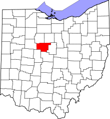 | |
| Villages | ||
| Townships | ||
| Unincorporated communities | ||
| Ghost town | ||