Céu Azul
| Céu Azul-Paraná Céu Azul-Paraná | |||
|---|---|---|---|
| Municipality | |||
| |||
| Nickname(s): Céu Azul-Paraná | |||
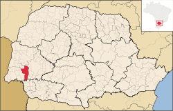 Location of Céu Azul in Paraná | |||
 Céu Azul-Paraná Location in Brazil | |||
| Coordinates: BR 25°8′49″S 53°50′56″W / 25.14694°S 53.84889°W | |||
| Country |
| ||
| Region | Southern | ||
| State | Paraná | ||
| Mesoregion | Oeste Paranaense | ||
| Government | |||
| • Mayor | Jaime Basso | ||
| Area | |||
| • Total | 455.4 sq mi (1,179.5 km2) | ||
| Population (2015) | |||
| • Total | 11,649 | ||
| • Density | 24.2/sq mi (9.35/km2) | ||
| Time zone | UTC -3 | ||
.jpg)

Céu Azul is a municipality in the state of Paraná in the Southern Region of Brazil.[1]
Céu Azul covers 1,179.5 square kilometres (455.4 sq mi), has a population of 11,649, and population density of 9.35 resident per square kilometer. 852 square kilometres (329 sq mi) of the city is preserved as Atlantic Forest and is part of Iguaçu National Park.[1][2]
The western region of Paraná was the target of logging companies in the 1950s. The company Pinho e Terras Ltda. installed a colony in the area in 1952 and brought workers, mainly from the state of Rio Grande do Sul. The first residents were primarily of German and Italian origin.[2]
See also
References
- 1 2 "Paraná: Céu Azul" (in Portuguese). Instituto Brasileiro de Geografia e Estatística. 2016. Retrieved 2016-07-25.
- 1 2 "História do município" (in Portuguese). Retrieved 2016-07-25.

Coordinates: 25°08′49″S 53°50′56″W / 25.1469°S 53.8489°W
This article is issued from Wikipedia - version of the 7/25/2016. The text is available under the Creative Commons Attribution/Share Alike but additional terms may apply for the media files.