Brumley, Missouri
| Brumley, Missouri | |
|---|---|
| Village | |
 Location of Brumley, Missouri | |
| Coordinates: 38°5′11″N 92°29′13″W / 38.08639°N 92.48694°WCoordinates: 38°5′11″N 92°29′13″W / 38.08639°N 92.48694°W | |
| Country | United States |
| State | Missouri |
| County | Miller |
| Area[1] | |
| • Total | 0.55 sq mi (1.42 km2) |
| • Land | 0.55 sq mi (1.42 km2) |
| • Water | 0 sq mi (0 km2) |
| Elevation | 778 ft (237 m) |
| Population (2010)[2] | |
| • Total | 91 |
| • Estimate (2012[3]) | 91 |
| • Density | 165.5/sq mi (63.9/km2) |
| Time zone | Central (CST) (UTC-6) |
| • Summer (DST) | CDT (UTC-5) |
| ZIP code | 65017 |
| Area code(s) | 573 |
| FIPS code | 29-08974[4] |
| GNIS feature ID | 0729447[5] |
Brumley is a village in Miller County, Missouri, United States. The population was 91 at the 2010 census.
History
There is uncertainty when Brumley was first laid out. Years given are 1858,[6] 1869,[7] and 1877.[6] The source of the name Brumley is also disputed.[6] A post office called Brumley has been in operation since 1863.[8]
Geography
Brumley is located at 38°5′11″N 92°29′13″W / 38.08639°N 92.48694°W (38.086442, -92.487045).[9]
According to the United States Census Bureau, the village has a total area of 0.55 square miles (1.42 km2), all of it land.[1]
Demographics
| Historical population | |||
|---|---|---|---|
| Census | Pop. | %± | |
| 1930 | 121 | — | |
| 1940 | 100 | −17.4% | |
| 1950 | 78 | −22.0% | |
| 1960 | 74 | −5.1% | |
| 1970 | 87 | 17.6% | |
| 1980 | 109 | 25.3% | |
| 1990 | 81 | −25.7% | |
| 2000 | 102 | 25.9% | |
| 2010 | 91 | −10.8% | |
| Est. 2015 | 93 | [10] | 2.2% |
2010 census
At the 2010 census,[2] there were 91 people, 40 households and 24 families residing in the village. The population density was 165.5 inhabitants per square mile (63.9/km2). There were 48 housing units at an average density of 87.3 per square mile (33.7/km2). The racial makeup of the village was 78.0% White, 6.6% African American, 4.4% Native American, and 11.0% from two or more races. Hispanic or Latino of any race were 5.5% of the population.
There were 40 households of which 32.5% had children under the age of 18 living with them, 40.0% were married couples living together, 15.0% had a female householder with no husband present, 5.0% had a male householder with no wife present, and 40.0% were non-families. 37.5% of all households were made up of individuals and 25% had someone living alone who was 65 years of age or older. The average household size was 2.28 and the average family size was 3.00.
The median age in the village was 40.5 years. 27.5% of residents were under the age of 18; 4.4% were between the ages of 18 and 24; 24.2% were from 25 to 44; 25.3% were from 45 to 64; and 18.7% were 65 years of age or older. The gender makeup of the village was 54.9% male and 45.1% female.
2000 census
At the 2000 census,[4] there were 102 people, 41 households and 27 families residing in the town. The population density was 211.3 per square mile (82.0/km²). There were 49 housing units at an average density of 101.5 per square mile (39.4/km²). The racial makeup of the town was 86.27% White, 7.84% Native American, and 5.88% from two or more races. Hispanic or Latino of any race were 3.92% of the population.
There were 41 households of which 31.7% had children under the age of 18 living with them, 48.8% were married couples living together, 9.8% had a female householder with no husband present, and 34.1% were non-families. 31.7% of all households were made up of individuals and 9.8% had someone living alone who was 65 years of age or older. The average household size was 2.49 and the average family size was 3.07.
28.4% of the population were under the age of 18, 5.9% from 18 to 24, 26.5% from 25 to 44, 23.5% from 45 to 64, and 15.7% who were 65 years of age or older. The median age was 36 years. For every 100 females there were 126.7 males. For every 100 females age 18 and over, there were 102.8 males.
The median household income was $22,500 and the median family income was $25,208. Males had a median income of $23,750 compared with $16,875 for females. The per capita income for the town was $10,468. There were 4.0% of families and 15.8% of the population living below the poverty line, including 16.0% of under-18s and 9.5% of those over 64.
References
- 1 2 "US Gazetteer files 2010". United States Census Bureau. Archived from the original on 2012-07-14. Retrieved 2012-07-08.
- 1 2 "American FactFinder". United States Census Bureau. Retrieved July 8, 2012.
- ↑ "Population Estimates". United States Census Bureau. Archived from the original on 2013-06-17. Retrieved 2013-05-30.
- 1 2 "American FactFinder". United States Census Bureau. Archived from the original on 2013-09-11. Retrieved 2008-01-31.
- ↑ "US Board on Geographic Names". United States Geological Survey. 2007-10-25. Retrieved 2008-01-31.
- 1 2 3 "Miller County Place Names, 1928–1945". The State Historical Society of Missouri. Archived from the original on June 24, 2016. Retrieved November 6, 2016.
- ↑ Eaton, David Wolfe (1916). How Missouri Counties, Towns and Streams Were Named. The State Historical Society of Missouri. p. 194.
- ↑ "Post Offices". Jim Forte Postal History. Retrieved 6 November 2016.
- ↑ "US Gazetteer files: 2010, 2000, and 1990". United States Census Bureau. 2011-02-12. Retrieved 2011-04-23.
- ↑ "Annual Estimates of the Resident Population for Incorporated Places: April 1, 2010 to July 1, 2015". Retrieved July 2, 2016.
- ↑ "Census of Population and Housing". Census.gov. Archived from the original on May 11, 2015. Retrieved June 4, 2015.
Municipalities and communities of Miller County, Missouri, United States | ||
|---|---|---|
| Cities | 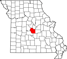 | |
| Villages | ||
| Townships | ||
| Unincorporated communities | ||
| Footnotes | ‡This populated place also has portions in an adjacent county or counties | |