British Columbia Highway 3A
| ||||
|---|---|---|---|---|
| Route information | ||||
| Existed: | 1964 – present | |||
| Tourist routes: | Part of the International Selkirk Loop | |||
| Castlegar-Nelson-Creston Highway | ||||
| Length: | 154 km (96 mi) | |||
| West end: |
| |||
| Major junctions: |
| |||
| East end: |
| |||
| Keremeos-Kaleden Junction Highway | ||||
| Length: | 35 km (22 mi) | |||
| West end: |
| |||
| East end: |
| |||
| Location | ||||
| Major cities: | Castlegar, Nelson | |||
| Towns: | Creston | |||
| Highway system | ||||
|
British Columbia provincial highways
| ||||

Highway 3A is the designation of two segments of highway in the southern part of British Columbia.
Castlegar-Nelson-Creston Highway
This was the first segment of highway in British Columbia to receive the '3A' designation. It acquired this designation when the Crowsnest Highway was routed into the Kootenay Pass area in 1964. Originally, a ferry was used to route Highway 3A over the Columbia River near Castlegar, which was replaced by a bridge in 1967.
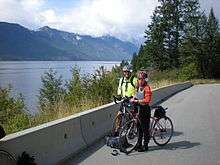
The 154 km (96 mi) long Kootenay section of Highway 3A begins at Castlegar, where it leaves Highway 3 and travels 20 km (12 mi) northeast to South Slocan, where Highway 6 merges onto Highway 3A. The two highways proceed east for 22 km (14 mi) to Nelson, where Highway 6 diverges south. 34 km (21 mi) northeast of Nelson, Highway 3A reaches Balfour, on the western shore of Kootenay Lake. A ferry takes Highway 3A across Kootenay Lake to Kootenay Bay. Highway 3A then follows the eastern shore of Kootenay Lake for 78 km (48 mi) south through Crawford Bay, Boswell, and Wynndel to Creston, where it rejoins Highway 3.[1]
Keremeos-Kaleden Junction Highway
A new section of highway through the Richter Pass from Keremeos to Osoyoos was opened in 1965.[2] The 2-lane Crowsnest Highway was re-routed through this area in 1967, and the segment between Keremeos and Osoyoos was given the Highway 3 Southern Trans-Canada designation. This 45 km (28 mi.) long segment of Highway 3 runs south from Keremeos, past the turnoff to Nighthawk, USA, then east over Richter Pass to Osoyoos. It's a main part of the bike course for the Challenge Penticton Triathlon (formerly Ironman - 2013) each August in the Okanagan-Similkameen.[3]
Highway 3A runs from Keremeos 35 km (22 mi) north through Olalla and up the long hill to Yellow Lake, then east past Twin Lakes and through the Marron Valley to Kaleden Junction where it intersects with Highway 97, the North-South Okanagan route, 14 km (9 mi) south of Penticton.[4] Highway 3A used to continue south along Highway 97, past Okanagan Falls and Oliver to Osoyoos, but the HIghway 3A/97 concurrency has since been decommissioned.[5]
Extra driving time should be allowed for traffic congestion (tourism) in the Okanagan in summer. There is also some agricultural traffic in both valleys. There is limited 3 and 4 laning.
See also
- Glass House (British Columbia) — a roadside attraction on highway 3A
External links
- Official Numbered Routes in British Columbia by British Columbia Driving & Transportation
References
- ↑ Super, Natural British Columbia Road Map & Parks Guide (Map) (2010-2011 ed). Davenport Maps Ltd. in co-operation with Tourism British Columbia. § L-11.
- ↑ "Frontier to Freeway: A short illustrated history of the roads in British Columbia" (PDF). British Columbia Ministry of Transportation and Highways. p. 21. Retrieved 27 June 2016.
- ↑ Waldner, Steve (23 August 2012). "Sunday's Ironman will be Penticton's last". Penticton Western News. Retrieved 27 June 2016.
- ↑ Super, Natural British Columbia Road Map & Parks Guide (Map) (2010-2011 ed). Davenport Maps Ltd. in co-operation with Tourism British Columbia. § L-10.
- ↑ Tourism British Columbia Road Map (Map) (1983 ed). Mapping Branch, Ministry of Environment. § L-10.