Boone Township, Dubois County, Indiana
| Boone Township | |
|---|---|
| Township | |
|
Lemmon Presbyterian Church, a historic site in the township | |
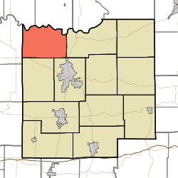 Location of Boone Township in Dubois County | |
| Coordinates: 38°28′23″N 87°00′44″W / 38.47306°N 87.01222°WCoordinates: 38°28′23″N 87°00′44″W / 38.47306°N 87.01222°W | |
| Country | United States |
| State | Indiana |
| County | Dubois |
| Government | |
| • Type | Indiana township |
| Area | |
| • Total | 33.55 sq mi (86.9 km2) |
| • Land | 33.25 sq mi (86.1 km2) |
| • Water | 0.29 sq mi (0.8 km2) |
| Elevation[1] | 456 ft (139 m) |
| Population (2010) | |
| • Total | 799 |
| • Density | 24/sq mi (9/km2) |
| FIPS code | 18-06526[2] |
| GNIS feature ID | 453127 |

Boone Township is one of twelve townships in Dubois County, Indiana. As of the 2010 census, its population was 799 and it contained 321 housing units.[3]
History
The Lemmon's Presbyterian Church was listed on the National Register of Historic Places in 1992.[4]
Geography
According to the 2010 census, the township has a total area of 33.55 square miles (86.9 km2), of which 33.25 square miles (86.1 km2) (or 99.11%) is land and 0.29 square miles (0.75 km2) (or 0.86%) is water.[3]
Unincorporated towns
Adjacent townships
- Reeve Township, Daviess County (north)
- Harbison Township (east)
- Bainbridge Township (southeast)
- Madison Township (south)
- Jefferson Township, Pike County (west)
- Harrison Township, Daviess County (northwest)
Major highways
Cemeteries
The township contains two cemeteries: Bethel and Sherritt.
References
- "Boone Township, Dubois County, Indiana". Geographic Names Information System. United States Geological Survey. Retrieved 2009-09-24.
- United States Census Bureau cartographic boundary files
- ↑ "US Board on Geographic Names". United States Geological Survey. 2007-10-25. Retrieved 2008-01-31.
- ↑ "American FactFinder". United States Census Bureau. Archived from the original on 2013-09-11. Retrieved 2008-01-31.
- 1 2 "Population, Housing Units, Area, and Density: 2010 - County -- County Subdivision and Place -- 2010 Census Summary File 1". United States Census. Retrieved 2013-05-10.
- ↑ National Park Service (2010-07-09). "National Register Information System". National Register of Historic Places. National Park Service.
External links
Municipalities and communities of Dubois County, Indiana, United States | ||
|---|---|---|
| Cities | ||
| Towns | ||
| Townships | ||
| CDP | ||
| Other unincorporated communities | ||
| Ghost town | ||
| Footnotes | ‡This populated place also has portions in an adjacent county or counties | |
This article is issued from Wikipedia - version of the 11/6/2016. The text is available under the Creative Commons Attribution/Share Alike but additional terms may apply for the media files.