Bocaranga
| Bocaranga | |
|---|---|
 Bocaranga | |
| Coordinates: 6°59′N 15°39′E / 6.983°N 15.650°ECoordinates: 6°59′N 15°39′E / 6.983°N 15.650°E | |
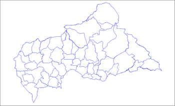
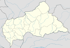
| Country | Central African Republic |
| Prefecture | Ouham-Pendé |
| Government | |
| • Sub-prefect | Aboukari Bi-Hamidou |
| Elevation | 1,072 m (3,517 ft) |
| Population (2003) | |
| • Total | 61,190 |
Bocaranga is a sub-prefecture in the prefecture of Ouham-Pendé in Central African Republic. The city must not be confused with Bocaranga I, Bocaranga II, Bocaranga III and Bocaranga IV. These are smaller villages along the road from Bocaranga to Bouar
History
The village of Bocaranga was ceded to German Kamerun on 4 November 1911. It went back to French Oubangi-Chari rule in 1914. In 1946 it became a district and on January 23, 1961 it became a sous-préfecture within the newly independent Central African Republic.[1]
Geography and climate
The city is located in the highlands of the northwest part of the country. It is surrounded by granite hills and rocks. Northwest of the city is Mount Bocaranga (1309 m), which is one of the highest points in the country.
Köppen-Geiger climate classification system classifies its climate as tropical wet and dry (Aw).[2]
| Climate data for Bocaranga | |||||||||||||
|---|---|---|---|---|---|---|---|---|---|---|---|---|---|
| Month | Jan | Feb | Mar | Apr | May | Jun | Jul | Aug | Sep | Oct | Nov | Dec | Year |
| Average high °C (°F) | 30.4 (86.7) |
32.2 (90) |
32 (90) |
30.3 (86.5) |
28.9 (84) |
27.2 (81) |
26 (79) |
25.9 (78.6) |
26.5 (79.7) |
28 (82) |
30.2 (86.4) |
30.8 (87.4) |
29.03 (84.28) |
| Daily mean °C (°F) | 22.4 (72.3) |
24.2 (75.6) |
25.3 (77.5) |
24.6 (76.3) |
23.7 (74.7) |
22.4 (72.3) |
21.7 (71.1) |
21.6 (70.9) |
21.7 (71.1) |
22.4 (72.3) |
22.8 (73) |
22.5 (72.5) |
22.94 (73.3) |
| Average low °C (°F) | 14.4 (57.9) |
16.2 (61.2) |
18.6 (65.5) |
19 (66) |
18.5 (65.3) |
17.7 (63.9) |
17.5 (63.5) |
17.3 (63.1) |
17 (63) |
16.9 (62.4) |
15.5 (59.9) |
14.2 (57.6) |
16.9 (62.44) |
| Average precipitation mm (inches) | 1 (0.04) |
5 (0.2) |
32 (1.26) |
85 (3.35) |
134 (5.28) |
172 (6.77) |
257 (10.12) |
295 (11.61) |
246 (9.69) |
139 (5.47) |
14 (0.55) |
1 (0.04) |
1,381 (54.38) |
| Source: Climate-Data.org, altitude: 1067m[2] | |||||||||||||
Transport
There is an airstrip outside town, Bocaranga Airport. The roads leading to Bocaranga are unpaved.
Notes and references
- ↑ - Subprefectures of the Central African Republic
- 1 2 "Climate: Bocaranga - Climate graph, Temperature graph, Climate table". Climate-Data.org. Retrieved 9 October 2013.