Bloomington, York Region, Ontario
| Bloomington | |
|---|---|
| Unincorporated community | |
| Coordinates: 44°0′24″N 79°15′51″W / 44.00667°N 79.26417°WCoordinates: 44°0′24″N 79°15′51″W / 44.00667°N 79.26417°W | |
| Country | Canada |
| Province | Ontario |
| Regional municipality | York Region |
| Town | Whitchurch–Stouffville |
| Amalgamation |
(With Town of Stouffville) 1 January 1971 |
| Government | |
| • Type | Municipality |
| • Mayor | Justin Altmann |
| • Councillor, Ward 4 | Rick Upton |
| • Councillor, Ward 5 | Iain Lovatt |
| Elevation | 320 m (1,050 ft) |
| Time zone | EST (UTC−5) |
| • Summer (DST) | EDT (UTC−4) |
| Forward sortation area | L4A |
| Area code(s) | 905 and 289 |
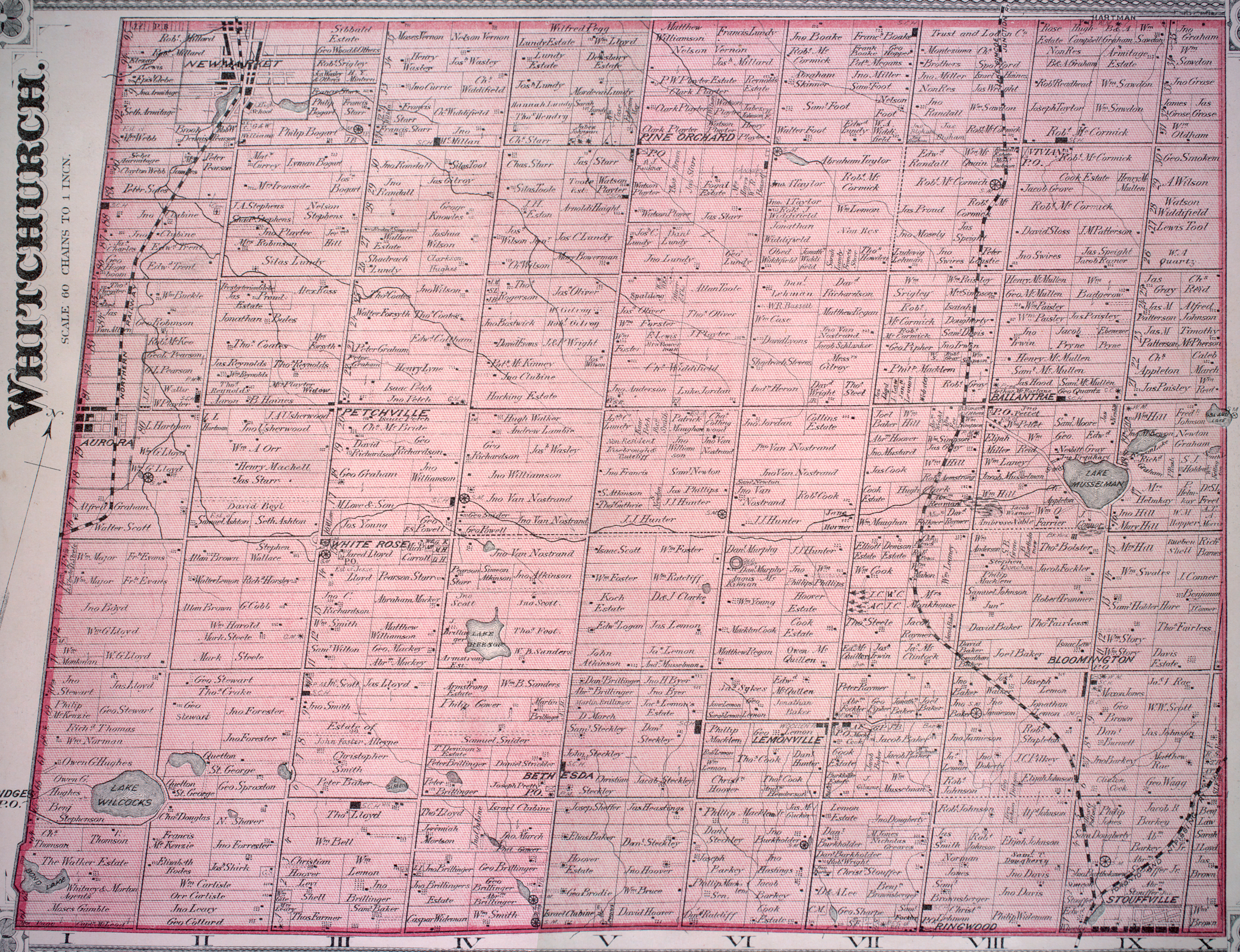
Bloomington is a hamlet in York Region, Ontario, Canada, in the town of Whitchurch–Stouffville. The hamlet is centred at the intersection of Ninth Line and Bloomington Road near the eastern boundary of the town of Whitchurch–Stouffville. Neighbouring communities within Whitchurch–Stouffville include Musselman Lake to the north, Lemonville to the west, and the community of urban Stouffville to the south. The hamlet of Goodwood in the town of Uxbridge lies to the east.[1]
The first settlers arrived in the early 19th century, and were largely Quakers, Mennonites and United Empire Loyalists who had left the United States. The first postmaster, S. Patterson, registered the name Bloomington in 1869, likely after the city of Bloomington, Illinois.[2]
References
- ↑ See the detailed 1878 map: Township of Whitchurch, Illustrated historical atlas of the county of York and the township of West Gwillimbury & town of Bradford in the county of Simcoe, Ont. (Toronto: Miles & Co., 1878).
- ↑ For a thorough account of Bloomington's history, cf. Jean Barkey et al., Whitchurch Township (Erin, ON: Boston Mills, 1993), 100-102.