Berrington, Northumberland
| Berrington | |
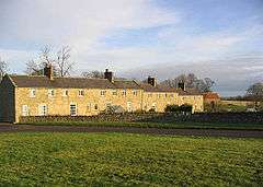 Houses at Berrington |
|
 Berrington |
|
| OS grid reference | NU005435 |
|---|---|
| District | Berwick-upon-Tweed |
| Shire county | Northumberland |
| Region | North East |
| Country | England |
| Sovereign state | United Kingdom |
| Post town | BERWICK-UPON-TWEED |
| Postcode district | TD15 |
| Police | Northumbria |
| Fire | Northumberland |
| Ambulance | North East |
| EU Parliament | North East England |
| UK Parliament | Berwick-upon-Tweed |
|
|
Coordinates: 55°41′06″N 1°59′38″W / 55.685°N 1.994°W
Berrington is a village in Northumberland, in England. It is situated to the south of Berwick-upon-Tweed, inland from the North Sea coast.
Governance
Berrington is in the parliamentary constituency of Berwick-upon-Tweed.
Landmarks
The Devil's Causeway passes the eastern edge of the settlement. The causeway is a Roman road which starts at Port Gate on Hadrian's Wall, north of Corbridge, and extends 55 miles (89 km) northwards across Northumberland to the mouth of the River Tweed at Berwick-upon-Tweed.
References
External links
| Wikimedia Commons has media related to Berrington, Northumberland. |
This article is issued from Wikipedia - version of the 4/15/2014. The text is available under the Creative Commons Attribution/Share Alike but additional terms may apply for the media files.