Benalla Airport
"YBLA" redirects here. For the guerrilla knitting group, see Yarnbombing Los Angeles.
| Benalla Airport | |||||||||||||||||||||||
|---|---|---|---|---|---|---|---|---|---|---|---|---|---|---|---|---|---|---|---|---|---|---|---|
| IATA: BLN – ICAO: YBLA | |||||||||||||||||||||||
| Summary | |||||||||||||||||||||||
| Airport type | Public | ||||||||||||||||||||||
| Operator | Benalla Rural City Council | ||||||||||||||||||||||
| Location | Benalla, Victoria | ||||||||||||||||||||||
| Elevation AMSL | 569 ft / 173 m | ||||||||||||||||||||||
| Coordinates | 36°33′06″S 146°00′24″E / 36.55167°S 146.00667°ECoordinates: 36°33′06″S 146°00′24″E / 36.55167°S 146.00667°E | ||||||||||||||||||||||
| Map | |||||||||||||||||||||||
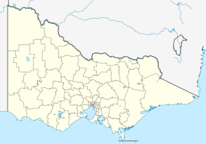 YBLA Location in Victoria | |||||||||||||||||||||||
| Runways | |||||||||||||||||||||||
| |||||||||||||||||||||||
Benalla Airport (IATA: BLN, ICAO: YBLA) is located east of Benalla, Victoria, Australia. Benalla Airport is the home of the Gliding Club of Victoria.
See also
References
- ↑ YBLA – Benalla (PDF). AIP En Route Supplement from Airservices Australia, effective 10 November 2016, Aeronautical Chart Archived 11 April 2012 at the Wayback Machine.
This article is issued from Wikipedia - version of the 12/4/2016. The text is available under the Creative Commons Attribution/Share Alike but additional terms may apply for the media files.