Mount Hotham Airport
| Mount Hotham Airport | |||||||||||
|---|---|---|---|---|---|---|---|---|---|---|---|
 | |||||||||||
| IATA: MHU – ICAO: YHOT | |||||||||||
| Summary | |||||||||||
| Airport type | Private | ||||||||||
| Operator | MHSC Transportation Services Pty Ltd. | ||||||||||
| Location |
Cobungra, | ||||||||||
| Elevation AMSL | 4,260 ft / 1,298 m | ||||||||||
| Coordinates | 37°02′51″S 147°20′03″E / 37.04750°S 147.33417°ECoordinates: 37°02′51″S 147°20′03″E / 37.04750°S 147.33417°E | ||||||||||
| Map | |||||||||||
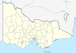 YHOT Location in Victoria | |||||||||||
| Runways | |||||||||||
| |||||||||||
Mount Hotham Airport (IATA: MHU, ICAO: YHOT) is a small Australian regional airport, which serves the Victorian ski resort of Mount Hotham. The airport opened in 2000, and it is Australia's highest-altitude airport.
Airlines and destinations
| Airlines | Destinations |
|---|---|
| Qantas Airways[nb 1] | Seasonal: Sydney |
- ↑ This service did not run during the 2014 season due to (forecast) lack of demand. (Source: Qantas Booking Information, 13 13 13, called 2014-09-02.)
One airline is looking to recommence services in 2015 with similar aircraft to those used by Qantaslink, but initially with fewer services.
Incidents and accidents
On 8 July 2005, a Piper PA-31-350 Navajo Chieftain charter plane crashed into terrain while attempting to make a landing at the airport, killing the pilot and two passengers. Fragments of the aircraft were said to have dropped on the ground at the nearby alpine community of Cobungra.[2]
See also
References
- ↑ YHOT – Mount Hotham (PDF). AIP En Route Supplement from Airservices Australia, effective 10 November 2016, Aeronautical Chart
- ↑ "Aviation Safety Investigation Report 200503265 - Collision with terrain, Piper PA-31-350 VH-OAO at Mt Hotham". Australian Transport Safety Bureau, Department of Transport and Regional Services, Government of Australia. Retrieved 2007-06-09.
This article is issued from Wikipedia - version of the 12/4/2016. The text is available under the Creative Commons Attribution/Share Alike but additional terms may apply for the media files.