Baugo Township, Elkhart County, Indiana
| Baugo Township | |
|---|---|
| Township | |
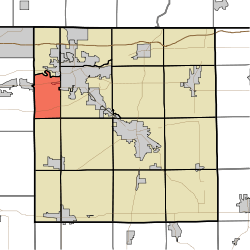 Location of Baugo Township in Elkhart County | |
| Coordinates: 41°38′36″N 86°01′49″W / 41.64333°N 86.03028°WCoordinates: 41°38′36″N 86°01′49″W / 41.64333°N 86.03028°W | |
| Country | United States |
| State | Indiana |
| County | Elkhart |
| Government | |
| • Type | Indiana township |
| Area | |
| • Total | 15.01 sq mi (38.9 km2) |
| • Land | 14.69 sq mi (38.0 km2) |
| • Water | 0.32 sq mi (0.8 km2) |
| Elevation[1] | 764 ft (233 m) |
| Population (2010) | |
| • Total | 9,431 |
| • Density | 642/sq mi (248/km2) |
| Area code(s) | 574 |
| FIPS code | 18-03754[2] |
| GNIS feature ID | 453099 |
Baugo Township is one of sixteen townships in Elkhart County, Indiana. As of the 2010 census, its population was 9,431.[3]
History
Baugo Township was named from the Baugo Creek, which is derived from the Indian name Baubaugo, meaning "devil river".[4]
Geography
According to the 2010 census, the township has a total area of 15.01 square miles (38.9 km2), of which 14.69 square miles (38.0 km2) (or 97.87%) is land and 0.32 square miles (0.83 km2) (or 2.13%) is water.[3]
Cities and towns
- Elkhart (southwest edge)
Adjacent townships
- Cleveland Township (north)
- Concord Township (east)
- Harrison Township (southeast)
- Olive Township (south)
- Penn Township, St. Joseph County (west)
Major highways
Cemeteries
The township contains two cemeteries: Noffsinger and Saint Vincent Depaul.
References
- "Baugo Township, Elkhart County, Indiana". Geographic Names Information System. United States Geological Survey. Retrieved 2009-09-24.
- United States Census Bureau cartographic boundary files
- ↑ "US Board on Geographic Names". United States Geological Survey. 2007-10-25. Retrieved 2008-01-31.
- ↑ "American FactFinder". United States Census Bureau. Archived from the original on 2013-09-11. Retrieved 2008-01-31.
- 1 2 "Population, Housing Units, Area, and Density: 2010 - County -- County Subdivision and Place -- 2010 Census Summary File 1". United States Census. Retrieved 2013-05-10.
- ↑ History of Elkhart County, Indiana. Chas. C. Chapman Co. 1881. p. 655.
External links
Municipalities and communities of Elkhart County, Indiana, United States | ||
|---|---|---|
| Cities | ||
| Towns | ||
| Townships | ||
| CDPs | ||
| Unincorporated communities | ||
| Footnotes | ‡This populated place also has portions in an adjacent county or counties | |
This article is issued from Wikipedia - version of the 10/29/2016. The text is available under the Creative Commons Attribution/Share Alike but additional terms may apply for the media files.