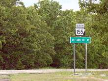
Arkansas Highway 155
| ||||
|---|---|---|---|---|
| Route information | ||||
| Maintained by AHTD | ||||
| Section 1 | ||||
| Length: | 7.10 mi[1] (11.43 km) | |||
| West end: | Mount Nebo State Park | |||
| East end: |
| |||
| Section 2 | ||||
| Length: | 7.56 mi[1] (12.17 km) | |||
| North end: |
| |||
| South end: |
| |||
| Section 3 | ||||
| Length: | 11.16 mi[1] (17.96 km) | |||
| South end: |
| |||
| North end: |
| |||
| Section 4 | ||||
| Length: | 2.68 mi[1] (4.31 km) | |||
| From: |
| |||
| To: |
| |||
| Location | ||||
| Counties: | Conway, Perry, Yell | |||
| Highway system | ||||
| ||||

Arkansas Highway 155 (AR 155 and Hwy. 155) is a designation for four state highways in Arkansas. The shortest segment of 7.10 miles (11.43 km) runs from Mount Nebo State Park to AR 22 in Dardanelle.[1] A second segment in Yell County of 7.56 miles (12.17 km) connects Highway 7 and Highway 154.[2] A third segment runs 11.16 miles (17.96 km) from AR 10 near Casa to Petit Jean State Park.[3] The fourth segment is a 2.68-mile (4.31 km) spur from Highway 60 south to an area near Deberrie.[4]
Route description
Mount Nebo State Park to Dardanelle
The route begins deep in Mount Nebo State Park surrounded by dense forest near the Mt. Nebo State Park Pavilion, listed on the National Register of Historic Places. Highway 155 winds out of the forest on a series of hairpin curves to eventually point due east toward Dardanelle. The route intersects with Highway 22 in the city and terminates.
Old Neely
The route begins at Arkansas Highway 7 and runs east and south[a 1] through Old Neely to Arkansas Highway 154 in a right-angle manner. The route does not cross or concur with any other state highways. The route essentially serves as giving Old Neely access to the state highway system.
Casa to Petit Jean State Park
The route begins at Arkansas Highway 10 just east of Casa and runs north to serve as a terminus for Highway 247 and Highway 324. AR 155 continues to wind through forests before terminating at Highway 154 in Petit Jean State Park near the historic Seven Hollows Site.
Highway 60 to Perry CR 14
Arkansas Highway 155 is a brief spur route that begins at Arkansas Highway 60. The route runs due south[a 2] to terminate near Deberrie, which is an unincorporated community.[4]
Major intersections
| County | Location | mi[1] | km | Destinations | Notes |
|---|---|---|---|---|---|
| Yell | Mount Nebo State Park | 0.00 | 0.00 | dead end | western terminus |
| Dardanelle | 7.10 | 11.43 | eastern terminus | ||
| AR 155 begins at Highway 7 | |||||
| | 0.00 | 0.00 | northern terminus | ||
| | 7.56 | 12.17 | southern terminus | ||
| AR 155 begins at AR 10 | |||||
| Perry | | 0.00 | 0.00 | southern terminus | |
| | 4.70 | 7.56 | |||
| | 7.61 | 12.25 | |||
| Conway | Petit Jean State Park | 11.16 | 17.96 | northern terminus | |
| AR 155 begins at AR 60 | |||||
| Perry | | 0.00 | 0.00 | northern terminus | |
| | 2.91 | 4.68 | southern terminus | ||
| 1.000 mi = 1.609 km; 1.000 km = 0.621 mi | |||||
Notes
- ↑ Although highways in the United States run from south to north and west to east, the Arkansas State Highway and Transportation Department lists Highway 155, Section 2 beginning at AR 7 and running south to AR 154.[2]
- ↑ Although highways in the United States run from south to north and west to east, the Arkansas State Highway and Transportation Department lists Highway 155, Section 6 beginning at AR 60 and running south.[4]
References
- 1 2 3 4 5 6 Planning and Research Division (2010). "Arkansas Road Log Database". Arkansas State Highway and Transportation Department. Archived from the original (Database) on 23 June 2011. Retrieved June 9, 2011.
- 1 2 Route and Section Map (PDF) (Map) (Yell County ed.). Arkansas State Highway and Transportation Department. Retrieved June 25, 2011.
- ↑ Route and Section Map (PDF) (Map) (Conway County ed.). Arkansas State Highway and Transportation Department. Retrieved June 25, 2011.
- 1 2 3 Route and Section Map (PDF) (Map) (Perry County ed.). Arkansas State Highway and Transportation Department. Retrieved June 25, 2011.