Arayat, Pampanga
For the mountain of the same name, see Mount Arayat.
| Arayat | ||
|---|---|---|
| Municipality | ||
|
Front of Arayat Municipal Hall | ||
| ||
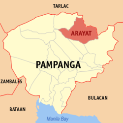 Map of Pampanga showing the location of Arayat | ||
.svg.png) Arayat Location within the Philippines | ||
| Coordinates: 15°09′N 120°46′E / 15.150°N 120.767°ECoordinates: 15°09′N 120°46′E / 15.150°N 120.767°E | ||
| Country | Philippines | |
| Region | Central Luzon (Region III) | |
| Province | Pampanga | |
| District | 3rd District | |
| Barangays | 30 | |
| Government[1] | ||
| • Mayor | Emmanuel Manahan Alejandrino | |
| Area[2] | ||
| • Total | 134.48 km2 (51.92 sq mi) | |
| Elevation | 8 m (26 ft) | |
| Population (2010)[3] | ||
| • Total | 121,348 | |
| • Density | 900/km2 (2,300/sq mi) | |
| Time zone | PST (UTC+8) | |
| ZIP code | 2012 | |
| Dialing code | +63 (0)45 | |
| Income class | 1st class | |
| Website |
www | |

Arayat is a first class municipality in the province of Pampanga, Philippines. According to the 2010 census, it has a population of 121,348 people.[3] A large portion of Mount Arayat is located within this municipality.
Barangays
Arayat is politically subdivided into 30 barangays.[2]
- Arenas
- Baliti
- Batasan
- Buensuceso
- Candating
- Gatiawin
- Guemasan
- La Paz (Turu)
- Lacmit
- Lacquios
- Mangga-Cacutud
- Mapalad
- Palinlang
- Paralaya
- Plazang Luma
- Poblacion
- San Agustin Norte
- San Agustin Sur
- San Antonio
- San Jose Mesulo
- San Juan Bano
- San Mateo
- San Nicolas
- San Roque Bitas
- Cupang (Santa Lucia)
- Matamo (Santa Lucia)
- Santo Niño Tabuan
- Suclayin
- Telapayong
- Kaledian (Camba)
Demographics
| Population census of Arayat | ||
|---|---|---|
| Year | Pop. | ±% p.a. |
| 1990 | 73,189 | — |
| 1995 | 85,940 | +3.05% |
| 2000 | 101,792 | +3.70% |
| 2007 | 118,312 | +2.10% |
| 2010 | 121,348 | +0.93% |
| Source: National Statistics Office[3][4] | ||
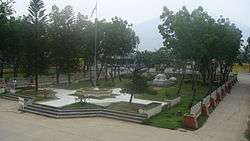
Gallery
|


Arayat Municipal Hall
Schools
- Exact College of Asia
- Arayat Institute
- Arayat National High School
- Camba High School
- Justino Sevilla High School
- Gatiawin High School
- Arayat Holy Child
- Blooming Fields Academy
- Adele Grace Montesori
- San Nicolas Elem. school
- Arenas Elementary School
References
- ↑ "Official City/Municipal 2013 Election Results". Intramuros, Manila, Philippines: Commission on Elections (COMELEC). 1 July 2013. Retrieved 17 September 2013.
- 1 2 "Province: Pampanga". PSGC Interactive. Makati City, Philippines: National Statistical Coordination Board. Retrieved 12 December 2012.
- 1 2 3 "Total Population by Province, City, Municipality and Barangay: as of May 1, 2010" (PDF). 2010 Census of Population and Housing. National Statistics Office. Archived from the original (PDF) on 15 November 2012. Retrieved 12 December 2012.
- ↑ "Province of Pampanga". Municipality Population Data. LWUA Research Division. Retrieved 16 August 2013.
External links
| Wikimedia Commons has media related to Arayat, Pampanga. |
- Philippine Standard Geographic Code
- Philippine Census Information
- Local Governance Performance Management System
 |
Magalang | |
Cabiao, Nueva Ecija | |
| Mexico | |
|||
| ||||
| | ||||
| Santa Ana | Candaba |
San Fernando (capital) | |
| Municipalities | |
| Component cities | |
| Highly urbanized city |
|
This article is issued from Wikipedia - version of the 10/17/2016. The text is available under the Creative Commons Attribution/Share Alike but additional terms may apply for the media files.