Anjō Station
Anjō Station 安城駅 | |
|---|---|
 | |
| Location |
Miyuki-Honmachi 1-1, Anjō, Aichi (愛知県安城市御幸本町1-1 [1]) Japan |
| Operated by | JR Central |
| Line(s) | Tōkaidō Main Line |
| History | |
| Opened | 1891 |
| Traffic | |
| Passengers (2006) | 10,400 [2] daily |
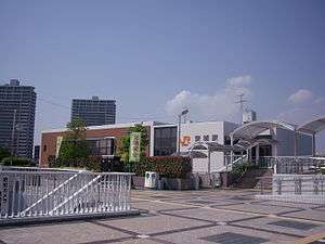
Anjō Station (安城駅 Anjō-eki) is a railway station on the Tōkaidō Main Line of Central Japan Railway Company in Anjō, Aichi Prefecture, Japan. The station is 333.7 rail kilometers from Tokyo Station.
History
Anjō Station was opened 16 June 1891 when the section of the Japanese Government Railways (JGR) line connecting Okazaki with Kariya was completed. This line was named Tōkaidō Line in 1895, and the Tōkaidō Main Line in 1909. An all-freight spur line operated by the privately held Hekinan Electric Railway connected Anjō to Hekinan in 1939 and began passenger operations from March 1951, but was discontinued in 1961. In October 1980, the JNR discontinued all freight services to Anjō Station. With the privatization and dissolution of the JNR on 1 April 1987, the station came under the control of the Central Japan Railway Company. At that time, an additional side platform was constructed.
Lines
Layout
Anjō Station has an island platform and two side platforms serving four tracks; however, only tracks 2 and 3 on the island platform are in normal operations. Track 1 is used for chartered and peak hour services, and use of track four was completely discontinued in 2010. The elevated station building has automated ticket machines, TOICA automated turnstiles and a manned "Green Window" service counter.
Platform
| 1 | ■ Tōkaidō Main Line | For Nagoya, Ōgaki |
| 2 | ■ Tōkaidō Main Line | For Okazaki, Toyohashi |
| 3 | ■ Tōkaidō Main Line | For Okazaki, Toyohashi |
| 4 | ■ Tōkaidō Main Line | not in service |
Adjacent stations
| « | Service | » | ||
|---|---|---|---|---|
| Central Japan Railway Company | ||||
| Tōkaidō Main Line | ||||
| Okazaki | Special Rapid | Kariya | ||
| Okazaki | New Rapid | Kariya | ||
| Okazaki | Rapid | Kariya | ||
| Okazaki | Sectional Rapid | Kariya | ||
| Nishi-Okazaki | Local | Mikawa-Anjō | ||
See also
-
 Media related to Anjō Station at Wikimedia Commons
References
- Yoshikawa, Fumio. Tokaido-sen 130-nen no ayumi. Grand-Prix Publishing (2002) ISBN 4-87687-234-1.(Japanese)
External links
- Anjō Station home page (Japanese)
Notes
- ↑ 安城駅 [Anjō Station] (in Japanese). JR Central. Retrieved 3 December 2010.
- ↑ 第10章 運輸・通信 (平成20年度刊愛知県統計年鑑) [Statistics of Aichi in Year 20 of the Heisei Era] (in Japanese). Aichi Prefecture. Retrieved 30 November 2010.
Coordinates: 34°57′37″N 137°05′14″E / 34.9602°N 137.0872°E