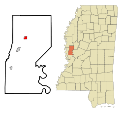
Anguilla, Mississippi
| Anguilla | |
|---|---|
| Town | |
 Location of Anguilla, Mississippi | |
 Anguilla Location in MS | |
| Coordinates: 32°58′26″N 90°49′47″W / 32.97389°N 90.82972°WCoordinates: 32°58′26″N 90°49′47″W / 32.97389°N 90.82972°W | |
| Country | United States |
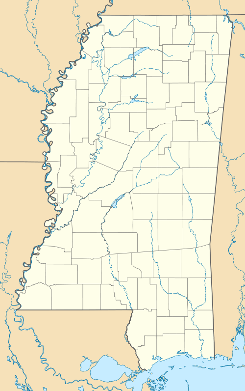
| State | Mississippi |
| County | Sharkey |
| Area | |
| • Total | 1.0 sq mi (2.7 km2) |
| • Land | 1.0 sq mi (2.7 km2) |
| • Water | 0.0 sq mi (0.0 km2) |
| Elevation | 105 ft (32 m) |
| Population (2010) | |
| • Total | 726 |
| • Density | 868.8/sq mi (335.4/km2) |
| Time zone | Central (CST) (UTC-6) |
| • Summer (DST) | CDT (UTC-5) |
| ZIP code | 38721 |
| Area code(s) | 662 |
| FIPS code | 28-01500 |
| GNIS feature ID | 0692402 |
Anguilla is a town in Sharkey County, Mississippi. The population was 726 at the 2010 census.
Geography
Anguilla is located at 32°58′26″N 90°49′47″W / 32.97389°N 90.82972°W (32.973889, -90.829645).[1]
According to the United States Census Bureau, the town has a total area of 1.0 square mile (2.6 km2), all land.
Demographics
As of the census[2] of 2010, there were 726 people, 266 households, and 191 families residing in the town. The population density was 868.8 people per square mile (336.7/km²). There were 301 housing units at an average density of 306.5 per square mile (118.8/km²). The racial makeup of the town was 77.8% African American, 21.2% White, 0.1% Asian, and 0.7% from two or more races. Hispanic or Latino of any race were 0.0% of the population.
There were 266 households out of which 32.3% had children under the age of 18 living with them, 31.6% were married couples living together, 33.5% had a female householder with no husband present, and 28.2% were non-families. 23.3% of all households were made up of individuals and 6.4% had someone living alone who was 65 years of age or older. The average household size was 2.73 and the average family size was 3.16.
| Historical population | |||
|---|---|---|---|
| Census | Pop. | %± | |
| 1920 | 361 | — | |
| 1930 | 467 | 29.4% | |
| 1940 | 493 | 5.6% | |
| 1950 | 601 | 21.9% | |
| 1960 | 580 | −3.5% | |
| 1970 | 612 | 5.5% | |
| 1980 | 950 | 55.2% | |
| 1990 | 883 | −7.1% | |
| 2000 | 907 | 2.7% | |
| 2010 | 726 | −20.0% | |
| Est. 2015 | 666 | [3] | −8.3% |
In the town the population was spread out with 28.2% under the age of 18, and 10.2% who were 65 years of age or older. The median age was 33.4 years. For every 100 females there were 92.6 males. For every 100 females age 18 and over, there were 76.8 males.
The median income for a household in the town was $19,712, and the median income for a family was $21,964. Males had a median income of $28,125 versus $15,833 for females. The per capita income for the town was $10,452. About 41.0% of families and 47.5% of the population were below the poverty line, including 66.6% of those under age 18 and 24.0% of those age 65 or over.
Education
The town of Anguilla is served by the South Delta School District.
Notable people
- Robert Anderson, a male singer, born in 1919.
- Antoine Cash, a former American football linebacker, born 1982.
- Ira Lee Harge, a retired American professional basketball player, born in 1942
- Joyce Kennedy, a female singer, in Anguilla 1948.
- Henry "Son" Sims, the Delta blues fiddler, who worked with Charlie Patton and Muddy Waters, was born in Anguilla in August 1890.[5] Professional basketball player Ira Harge was born in Anguilla in 1941.[6]
2015 description
In his 2015 travel book entitled Deep South: Four Seasons on Back Roads, author Paul Theroux describes the town as "desolate, a scattering of mobile homes at the edge of the road and bordering the plowed fields--decayed, rusted boxes, lying higgledy-piggedly with an air of disorder and desperation, like a refugee camp, which it was, in a way."[7]
References
- ↑ "US Gazetteer files: 2010, 2000, and 1990". United States Census Bureau. 2011-02-12. Retrieved 2011-04-23.
- ↑ "American FactFinder". United States Census Bureau. Archived from the original on 2013-09-11. Retrieved 2008-01-31.
- ↑ "Annual Estimates of the Resident Population for Incorporated Places: April 1, 2010 to July 1, 2015". Retrieved July 2, 2016.
- ↑ "Census of Population and Housing". Census.gov. Archived from the original on May 11, 2015. Retrieved June 4, 2015.
- ↑ "Henry "Son" Sims". AllMusic. Retrieved 2012-03-16.
- ↑ "Ira Harge". Retrieved 5 December 2015.
- ↑ Theroux, Paul (2015). Deep South: Four Seasons on Back Roads. London, UK: Hamish Hamilton. p. 117. ISBN 9780241146729.
Municipalities and communities of Sharkey County, Mississippi, United States | ||
|---|---|---|
| City | 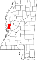 | |
| Towns | ||
| Unincorporated communities | ||