Prachantakham District
| Prachantakham ประจันตคาม | |
|---|---|
| Amphoe | |
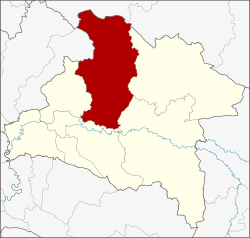 Amphoe location in Prachinburi Province | |
| Coordinates: 14°3′53″N 101°30′55″E / 14.06472°N 101.51528°ECoordinates: 14°3′53″N 101°30′55″E / 14.06472°N 101.51528°E | |
| Country |
|
| Province | Prachinburi |
| Area | |
| • Total | 904.005 km2 (349.038 sq mi) |
| Population (2005) | |
| • Total | 52,570 |
| • Density | 58.2/km2 (151/sq mi) |
| Time zone | ICT (UTC+7) |
| Postal code | 25130 |
| Geocode | 2507 |
Prachantakham (Thai: ประจันตคาม, pronounced [prā.t͡ɕān.tā.kʰāːm]) is a district (amphoe) of Prachinburi Province, eastern Thailand.
Geography
Neighboring districts are (from the east clockwise) Na Di, Kabin Buri, Si Maha Phot, Mueang Prachinburi of Prachinburi Province, Pak Phli of Nakhon Nayok Province, Pak Chong and Wang Nam Khiao of Nakhon Ratchasima Province.
The Sankamphaeng Range mountains is in the northern section of this district.
Administration
The district is divided into nine sub-districts (tambon), which are further subdivided into 106 villages (muban). Prachantakham is a township (thesaban tambon) which covers parts of tambon Prachantakham. There are a further nine tambon administrative organizations (TAO).
| No. | Name | Thai name | Villages | Pop. | |
|---|---|---|---|---|---|
| 1. | Prachantakham | ประจันตคาม | 11 | 8,977 | |
| 2. | Ko Loi | เกาะลอย | 7 | 4,704 | |
| 3. | Ban Hoi | บ้านหอย | 10 | 4,479 | |
| 4. | Nong Saeng | หนองแสง | 6 | 3,394 | |
| 5. | Dong Bang | ดงบัง | 10 | 4,054 | |
| 6. | Kham Tanot | คำโตนด | 18 | 7,054 | |
| 7. | Bu Fai | บุฝ้าย | 13 | 4,859 | |
| 8. | Nong Kaeo | หนองแก้ว | 12 | 4,651 | |
| 9. | Pho Ngam | โพธิ์งาม | 19 | 10,398 |
References
External links
- amphoe.com (Thai)
This article is issued from Wikipedia - version of the 4/16/2016. The text is available under the Creative Commons Attribution/Share Alike but additional terms may apply for the media files.