Noen Maprang District
| Noen Maprang เนินมะปราง | |
|---|---|
| Amphoe | |
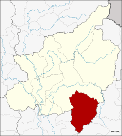 Amphoe location in Phitsanulok Province | |
| Coordinates: 16°34′6″N 100°38′8″E / 16.56833°N 100.63556°ECoordinates: 16°34′6″N 100°38′8″E / 16.56833°N 100.63556°E | |
| Country |
|
| Province | Phitsanulok |
| Area | |
| • Total | 1,029.55 km2 (397.51 sq mi) |
| Population (2005) | |
| • Total | 58,689 |
| • Density | 57.0/km2 (148/sq mi) |
| Time zone | THA (UTC+7) |
| Postal code | 65190 |
| Geocode | 6509 |
Noen Maprang (Thai: เนินมะปราง) is the southernmost district (Amphoe) of Phitsanulok Province, northern Thailand.
History
To better cope with the problems caused by communist insurgents in northern Thailand in the 1970s, the government separated Tambon Noen Maprang from Wang Thong district to create a minor district (King Amphoe) on September 6, 1976.[1] It was upgraded to a full district on April 1, 1983.[2]
Geography
Neighboring districts are (from the north clockwise) Wang Thong of Phitsanulok Province, Khao Kho, Mueang Phetchabun, Wang Pong of Phetchabun Province, Thap Khlo, Wang Sai Phun and Sak Lek of Phichit Province.
Noen Maprang lies within the Nan Basin, which is part of the Chao Phraya Watershed. Within the district is the source of the Chomphu River.[3] The Ban Mung (Thai: คลองบ้านมุง) and Sai Yoi (คลองไทรย้อย) Rivers also flow through the district.
Administration
The district is subdivided into 7 subdistricts, which are further subdivided into 75 villages (muban). Noen Maprang is a township (thesaban tambon) covering parts of tambon Noen Maprang. There are further 7 Tambon administrative organizations (TAO).
| No. | Name | Thai name | Villages | Inh. | |
|---|---|---|---|---|---|
| 1. | Chomphu | ชมพู | 15 | 13,266 | |
| 2. | Ban Mung | บ้านมุง | 8 | 6,944 | |
| 3. | Sai Yoi | ไทรย้อย | 16 | 8,784 | |
| 4. | Wang Phrong | วังโพรง | 9 | 7,389 | |
| 5. | Ban Noi Sum Khilek | บ้านน้อยซุ้มขี้เหล็ก | 11 | 8,210 | |
| 6. | Noen Maprang | เนินมะปราง | 9 | 8,209 | |
| 7. | Wang Yang | วังยาง | 7 | 5,887 |
Recent Flooding
On October 4, 2007, 100 rescue workers and 100 soldiers were dispatched to assist stranded residents in tambon Chompu and tambon Ban Mung, where water levels rose more than a meter.[4] On that same day, Phitsanulok Governor Somboon Sripattanawat declared the Noen Maprang District a disaster zone.[4]
References
- ↑ ประกาศกระทรวงมหาดไทย เรื่อง แบ่งท้องที่อำเภอวังทอง จังหวัดพิษณุโลก ตั้งเป็นกิ่งอำเภอเนินมะปราง (PDF). Royal Gazette (in Thai). 93 (106 ง special): 17. August 27, 1976.
- ↑ พระราชกฤษฎีกาตั้งอำเภอเทพสถิต อำเภอวังน้ำเย็น อำเภอเนินมะปราง อำเภอสวนผึ้ง และอำเภอเสนางคนิคม พ.ศ. ๒๕๒๖ (PDF). Royal Gazette (in Thai). 100 (50 ก special): 10–12. March 31, 1983.
- ↑ Google Earth
- 1 2 Phitsanulok Residents stranded in flash floods
External links
- amphoe.com (Thai)