Khong Chai District
| Khong Chai ฆ้องชัย | |
|---|---|
| Amphoe | |
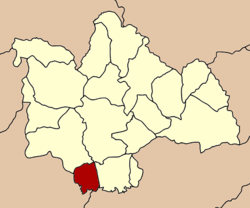 Amphoe location in Kalasin Province | |
| Coordinates: 16°15′42″N 103°27′30″E / 16.26167°N 103.45833°ECoordinates: 16°15′42″N 103°27′30″E / 16.26167°N 103.45833°E | |
| Country |
|
| Province | Kalasin |
| Seat | Khong Chai Phatthana |
| Area | |
| • Total | 128.3 km2 (49.5 sq mi) |
| Population (2005) | |
| • Total | 27,098 |
| • Density | 211.2/km2 (547/sq mi) |
| Time zone | ICT (UTC+7) |
| Postal code | 46130 |
| Geocode | 4618 |
Khong Chai (Thai: ฆ้องชัย) is a district (amphoe) in the southern part of Kalasin Province, northeastern Thailand.
Geography
Neighboring districts are (from the north clockwise) Yang Talat, Mueang Kalasin, Kamalasai of Kalasin Province, Changhan of Roi Et Province, Mueang Maha Sarakham and Kantharawichai of Maha Sarakham Province.
History
Mueang Fa Daet Song Yang (Thai: เมืองฟ้าแดดสงยาง) is the site of a prehistoric community surrounded by earthen mounds about 5 kilometres long. Evidence of its civilization are religious ruins in and around it, and a large concentration of boundary stones called bai sema or sema hin (ใบเสมา, เสมาหิน.)[1]
The minor district (king amphoe) was split off from Kamalasai district on 1 July 1997.[2]
Following a decision of the Thai government on 15 May 2007, all 81 minor districts were upgraded to full districts.[3] With publication in the Royal Gazette on 24 August, the upgrade became official.[4]
Administration
The district is subdivided into five subdistricts (tambon), which are further subdivided into 48 villages (muban). There are no municipal (thesaban) areas, and five tambon administrative organizations (TAO).
| No. | Name | Thai name | Villages | Inh. | |
|---|---|---|---|---|---|
| 1. | Khong Chai Phatthana | ฆ้องชัยพัฒนา | 11 | 6,658 | |
| 2. | Lao Klang | เหล่ากลาง | 8 | 4,541 | |
| 3. | Khok Sa-at | โคกสะอาด | 12 | 7,531 | |
| 4. | Non Sila Loeng | โนนศิลาเลิง | 9 | 4,556 | |
| 5. | Lam Chi | ลำชี | 8 | 3,812 |
References
- ↑ Phetsanghan, Phairot (2009). "Sema Hin Isan, the Origin of the Temple Boundary Stones in Northeast Thailand". The Social Sciences. 4 (2): 186–190. Archived from the original (PDF) on 2013-07-31. Retrieved 31 Jul 2013.
...Field research was conducted primarily at the ancient community of Muang Fah Daed Sohn [sic] Yang where 432 Sema Hin stones have been identified and registered with the Department of Fine Arts
- ↑ ประกาศกระทรวงมหาดไทย เรื่อง แบ่งเขตท้องที่อำเภอกมลาไสย จังหวัดกาฬสินธุ์ ตั้งเป็นกิ่งอำเภอฆ้องชัย (PDF). Royal Gazette (in Thai). 114 (Special 51 ง): 4. 25 Jun 1997.
- ↑ แถลงผลการประชุม ครม. ประจำวันที่ 15 พ.ค. 2550 (in Thai). Manager Online.
- ↑ พระราชกฤษฎีกาตั้งอำเภอฆ้องชัย...และอำเภอเหล่าเสือโก้ก พ.ศ. ๒๕๕๐ (PDF). Royal Gazette (in Thai). 124 (46 ก): 14–21. 24 Aug 2007.