Na Khu District
| Na Khu นาคู | |
|---|---|
| Amphoe | |
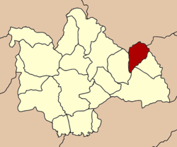 Amphoe location in Kalasin Province | |
| Coordinates: 16°46′48″N 104°1′54″E / 16.78000°N 104.03167°ECoordinates: 16°46′48″N 104°1′54″E / 16.78000°N 104.03167°E | |
| Country |
|
| Province | Kalasin |
| Seat | Na Khu |
| Area | |
| • Total | 203.0925 km2 (78.4145 sq mi) |
| Population (2005) | |
| • Total | 31,510 |
| • Density | 211.2/km2 (547/sq mi) |
| Time zone | ICT (UTC+7) |
| Postal code | 46160 |
| Geocode | 4616 |
Na Khu (Thai: นาคู) is a district (amphoe) in the eastern part of Kalasin Province, northeastern Thailand.
Geography
Neighboring districts are (from the south clockwise) Khao Wong, Kuchinarai, and Huai Phueng of Kalasin Province, Phu Phan and Tao Ngoi of Sakon Nakhon Province, and Dong Luang of Mukdahan Province.
History
The minor district (king amphoe) was created on 1 April 1995, when it was split off from Khao Wong.[1]
Following a decision of the Thai government on 15 May 2007, all 81 minor districts were upgraded to full districts.[2] With publication in the Royal Gazette on 24 August, the upgrade became official.[3]
Administration
The district is subdivided into five subdistricts (tambon), which are further subdivided into 54 villages (muban). Na Khu is a township (thesaban tambon) which covers parts of tambon Na Khu. There are further five tambon administrative organizations (TAO).
| No. | Name | Thai name | Villages | Inh. | |
|---|---|---|---|---|---|
| 1. | Na Khu | นาคู | 13 | 9,799 | |
| 2. | Sai Na Wang | สายนาวัง | 8 | 4,117 | |
| 3. | Non Na Chan | โนนนาจาน | 9 | 4,747 | |
| 4. | Bo Kaeo | บ่อแก้ว | 14 | 8,780 | |
| 5. | Phu Laen Chang | ภูแล่นช้าง | 10 | 4,067 |
References
- ↑ ประกาศกระทรวงมหาดไทย เรื่อง แบ่งเขตท้องที่อำเภอเขาวง จังหวัดกาฬสินธุ์ ตั้งเป็นกิ่งอำเภอนาคู (PDF). Royal Gazette (in Thai). 112 (Special 9 ง): 69. 22 Mar 1995.
- ↑ แถลงผลการประชุม ครม. ประจำวันที่ 15 พ.ค. 2550 (in Thai). Manager Online.
- ↑ พระราชกฤษฎีกาตั้งอำเภอฆ้องชัย...และอำเภอเหล่าเสือโก้ก พ.ศ. ๒๕๕๐ (PDF). Royal Gazette (in Thai). 124 (46 ก): 14–21. 24 Aug 2007.